Click to visit the main New York Public Library Homepage
The New York Public Library
Digital Collections
About Digital Collections
Browse
Search only public domain materials
Items
Collections
Divisions
Home
Search
Browse
About
Search only public domain materials
Items
Collections
Divisions
Digital Collections
Using Images
Using Data
Search
Filtered search
Show filters
Hide filters
Show Only Public Domain
topic
x
Administrative and political divisions
Landowners
32
Real property
28
Railroads
25
Canals
11
More
Less
name
Smith, Robert Pearsall, 1827-1898
10
Walling, Henry Francis, 1825-1888
9
Colton, J. H. (Joseph Hutchins), 1800-1893
8
Vaughan, David, active 1849-1864
6
J.H. Colton & Co
5
More
Less
collection
Maps of North America
57
Maps of New York City and State
52
place
New York (State)
49
New York (N.Y.)
12
Massachusetts
11
Brooklyn (New York, N.Y.)
10
Connecticut
9
More
Less
genre
Maps
109
Cadastral maps
22
Diagrams
1
Illustrations
1
Pictorial works
1
More
Less
publisher
publisher not identified
9
J.H. Colton
5
Surveyor General's Office
3
B.M. Norman
2
Charles Magnus
2
More
Less
division
Map Division
109
type
x
cartographic
still image
4
Date Range
to
109 results found
Filtering on:
x
Date
: 1849 - 1859
x
Topic
: Administrative and political divisions
x
Type
: cartographic
Sort by:
Title
Date created
Date digitized
Sequence
m
Map of the consolidated City …
Plan of the city of Philadelp…
The city of Chicago, Cook Co.…
m
Map of Rockingham Co., New Ha…
m
Norman's plan of New Orleans …
m
Norman's plan of New Orleans …
Kentucky
m
Map of Clinton Co., New York:…
Plan of the city of Philadelp…
m
Chapman's new sectional map o…
Chapman's sectional map of Wi…
Map of the city of Milwaukee,…
m
A sectional map of Iowa
A plat exhibiting the state o…
A new map of the state of Ohio
Reduced map of the state of C…
Map of the surveyed portions …
m
The city of Charleston, South…
m
Map of Loudoun County, Virgin…
California
Map of the states of Missouri…
m
Colton's map of the state of …
Map of the city of Chicago
Indiana, 1820
A map of the state of Virgini…
New sectional map of the stat…
m
Topographical map of the Coun…
m
Bonner's pocket map of the st…
Map of the state of Vermont
Map of Bennington County, Ver…
A map of a tract of land in t…
m
Map of Essex County, New Jers…
A plat exhibiting the state o…
m
Map of the State of Rhode Isl…
A map of the city of Providen…
m
New map of Burlington County:…
m
A new map of Arkansas with it…
m
Map of the city of Newark, N.…
A new map of the city of Buff…
Colton's railroad & township …
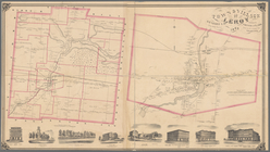
Town & Village of Leroy, Gene…
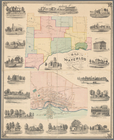
Map of the town of Waterloo, …
Town & village of Seneca Fall…
Southern New England
Topographical map of New York…
Map of the city of Concord, N…
m
A topographical map of Lincol…
m
Colton's railroad & township …
Map of the village of Taunton…
Map of the town of Tiverton, …