Click to visit the main New York Public Library Homepage
The New York Public Library
Digital Collections
About Digital Collections
Browse
Search only public domain materials
Items
Collections
Divisions
Home
Search
Browse
About
Search only public domain materials
Items
Collections
Divisions
Digital Collections
Using Images
Using Data
Search
Filtered search
Show filters
Hide filters
Show Only Public Domain
topic
Real property
408
Nautical charts
152
Landowners
137
Administrative and political divisions
109
Fire insurance
104
More
Less
name
Perris, William
297
United States Coast Survey
168
Bache, A. D. (Alexander Dallas), 1806-1867
152
Perris & Browne
130
New York (N.Y.). Common Council
88
More
Less
collection
Maps of North America
501
Atlases of New York City
356
Maps of New York City and State
355
Cigarette cards
51
Denkmaeler aus Aegypten und Aethiopien nach den Zeichnungen der von seiner Majestat dem Koenige von Preussen Friedrich Wilhelm IV nach diesen Landern gesendeten und in den Jahren 1842-1845 ausgefuhrten wissenschaftlichen Expedition ..
39
More
Less
place
New York (State)
486
New York
332
Manhattan (New York, N.Y.)
288
New York (N.Y.)
156
Brooklyn (New York, N.Y.)
77
More
Less
genre
Maps
1322
Nautical charts
134
Cadastral maps
112
Prints
78
Bathymetric maps
67
More
Less
publisher
William Perris
142
Perris & Browne
124
U.S. Coast Survey
90
publisher not identified
89
U.S. Coast Survey Office
42
More
Less
division
Map Division
1095
General Research Division
62
George Arents Collection
51
Rare Book Division
13
Milstein Division
5
More
Less
type
x
cartographic
still image
93
text
71
Date Range
to
1,372 results found
Filtering on:
x
Date
: 1849 - 1859
x
Type
: cartographic
Sort by:
Title
Date created
Date digitized
Sequence
Map of the Butterfield Overla…
m
Plan of the Land in Haverhill…
m
Topographical map of the coun…
A map of part of the land in …
Map of Livingston Manor anno …
Lake George and part of Lake …
Plan of the battle of Monmouth
Map exhibiting the fixed loca…
m
Topographical map of the Coun…
Topographical map of the coun…
Map of Waldo County, Maine: f…
Map of Pacific Railroad Free …
m
Map of Ontario County, New Yo…
Entrance to San Francisco Bay…
Preliminary chart of the Rigo…
m
Map of Baltimore
m
Stony Point and Verplanck's P…
Plan of the estate of Saml. O…
San Diego Bay, California
Map of the cities of New York…
Preliminary chart of San Pedr…
Patapsco River and the approa…
m
Map of Orange and Rockland Co…
Preliminary chart of Port Roy…
Johnson's new illustrated & e…
Geognosticheskaia karta bereg…
Karta rasprostraneniia dreves…
Plan chasti goroda Aiguna
Plan Albazinskago ukrepleniia…
m
Preliminary chart of Port Roy…
A description of the towne of…
A description of the towne of…
Grover & Baker's map of the s…
Geological and land patent ma…
Map of the lateral rail roads…
m
Map of Cayuga and Seneca Coun…
m
Johnson's new illustrated & e…
Map of Drainage System on Low…
Map of the city of Milwaukee,…
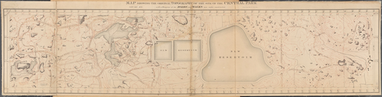
Map Showing the Original Topo…
Muskeget Channel, Massachuset…
Map of the State of Georgia
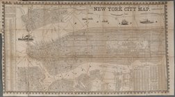
New York City Map
Map of part of the village of…
Hempstead
Hydrographic reconnaissance o…
A map of the state of Virgini…
Leavitt's map with views of t…
m
Map of Belknap County, New Ha…
Preliminary chart of Bull's B…
1
2
3
4
5
6
Previous
Next
1
2
3
4
5
6
Previous
Next