Click to visit the main New York Public Library Homepage
The New York Public Library
Digital Collections
About Digital Collections
Browse
Search only public domain materials
Items
Collections
Divisions
Home
Search
Browse
About
Search only public domain materials
Items
Collections
Divisions
Digital Collections
Using Images
Using Data
Search
Filtered search
Show filters
Hide filters
Show Only Public Domain
topic
Real property
10161
Fire insurance
5288
Cities & towns
4997
Administrative and political divisions
749
Railroads
709
More
Less
name
Sanborn Map Company
5090
G.W. Bromley & Co
2091
Bromley, George Washington
797
Bromley, Walter Scott
797
Austro-Hungarian Monarchy. Militärgeographisches Institut
773
More
Less
collection
Atlases of New York City
9897
Atlases of the United States
3494
Maps of North America
2377
Maps of New York City and State
1668
Spezialkarte der Osterreichisch-Ungarischen Monarchie
773
More
Less
place
New York (State)
11256
New York
3824
Manhattan (New York, N.Y.)
2059
New York (N.Y.)
1460
Brooklyn (New York, N.Y.)
1140
More
Less
genre
Maps
18720
Atlases
3447
Topographic maps
1017
Cadastral maps
500
Prints
196
More
Less
publisher
Sanborn Map Company
5126
G.W. Bromley & Co
1914
E. Belcher Hyde
780
K.u.K. Militargeographisches Institut
773
E. Robinson Co
334
More
Less
division
Map Division
18217
General Research Division
251
Schomburg Jean Blackwell Hutson Research and Reference Division
84
Manuscripts and Archives Division
71
George Arents Collection
51
More
Less
type
x
cartographic
text
295
still image
206
Date Range
to
18,936 results found
Filtering on:
x
Date
: 1850 - 1930
x
Type
: cartographic
Sort by:
Title
Date created
Date digitized
Sequence
Results 2251 - 2300
Plan der Descente und der Aff…
War map of Kentucky
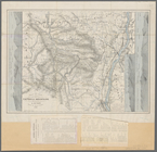
County map of Kentucky and Te…
Preliminary reconnaissance of…
Reconnaissance of the entranc…
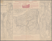
Rand McNally & Co.'s Maryland…
Harbor of Pass Christian, Mis…
Map of the seat of war in Mar…
Cat and Ship Island harbors :…
Post route map of the states …
Map of Northumberland County,…
Map of the city of Jacksonvil…
Map of the Parish of Carroll,…
Map of the Valley Furnace Est…
Preliminary chart of the Rigo…
Map of property of the Bloomi…
[S]econd Geolo[gical Survey o…
Geological map of Potter Coun…
The city of Boca Grande, Lee …
Johnson's Kentucky and Tennes…
Preliminary reconnaissance of…
Preliminary map : compiled fr…
Map of Kentucky and Tennessee…
Biloxi Bay, Mississippi : fro…
Plate III: Map of New Orleans…
Plate IV: Map of New Orleans…
Map showing condition and pro…
A Plan of the action at Bunke…
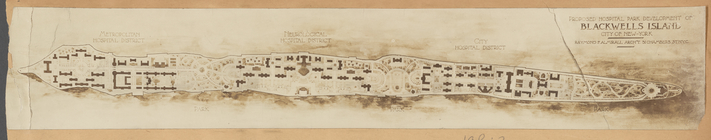
Plan of proposed hospital par…
Sketch F, showing the progres…
Rand, McNally & Co.'s indexed…
Map of proposed main sewerage…
Map of proposed main sewerage…
Sketch F showing the progress…
Map of the city of Washington…
Map of south Florida : showin…
A new sectional map of Florid…
Atlantic and Gulf Coast Canal…
Palisades of the Potomac [Fox…
Map of the City of Wilmington…
Map of Bennington County, Ver…
A new sectional map of Florid…
State of Florida: compiled fr…
Map of the state of Florida
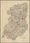
Map of the head waters of the…
Aqueduct Commissioners topogr…
Map showing the only all rail…
m
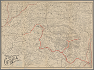
Maps of the picturesque Catsk…
m
Map of the Catskill Mountains
Karte der Wasserstrassen im n…
1
2
…
7
8
9
10
11
12
13
14
…
75
76
Previous
Next
1
2
…
7
8
9
10
11
12
13
14
…
75
76
Previous
Next