Click to visit the main New York Public Library Homepage
The New York Public Library
Digital Collections
About Digital Collections
Browse
Search only public domain materials
Items
Collections
Divisions
Home
Search
Browse
About
Search only public domain materials
Items
Collections
Divisions
Digital Collections
Using Images
Using Data
Search
Filtered search
Show filters
Hide filters
Show Only Public Domain
topic
Real property
10544
Fire insurance
5289
Cities & towns
4998
Administrative and political divisions
753
Railroads
711
More
Less
name
Sanborn Map Company
5093
G.W. Bromley & Co
2471
Bromley, George Washington
797
Bromley, Walter Scott
797
Austro-Hungarian Monarchy. Militärgeographisches Institut
773
More
Less
collection
Atlases of New York City
10577
Atlases of the United States
3497
Maps of North America
2400
Maps of New York City and State
1689
Spezialkarte der Osterreichisch-Ungarischen Monarchie
773
More
Less
place
New York (State)
11669
New York
3852
Manhattan (New York, N.Y.)
2265
New York (N.Y.)
2107
Brooklyn (New York, N.Y.)
1141
More
Less
genre
Maps
19503
Atlases
3451
Topographic maps
1046
Cadastral maps
500
Prints
198
More
Less
publisher
Sanborn Map Company
5129
G.W. Bromley & Co
2294
E. Belcher Hyde
780
K.u.K. Militargeographisches Institut
773
E. Robinson Co
334
More
Less
division
Map Division
18966
General Research Division
263
Manuscripts and Archives Division
96
Schomburg Jean Blackwell Hutson Research and Reference Division
88
George Arents Collection
51
More
Less
type
x
cartographic
text
359
still image
214
Date Range
to
19,736 results found
Filtering on:
x
Date
: 1850 - 1995
x
Type
: cartographic
Sort by:
Title
Date created
Date digitized
Sequence
Results 251 - 300
m
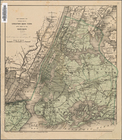
Map of the borough of Brookly…
Plan of Bay Ridge Parkway
Map of the enlarged city of B…
m
New map of Kings and Queens c…
New map of Brooklyn and vicin…
m
Map of the city of Brooklyn
Map of the county of Kings, s…
Watson's new map of the city …
Map of the city of Brooklyn
m
Map of the consolidated City …
m
Map of the City of Brooklyn a…
m
Topographical map of the city…
m
Peremptory sale of a suburban…
m
Plan of property situate in t…
Plan of the town of Brooklyn …
Map of the 23rd and 24th ward…
Mapa de la ciudad de Nueva Yo…
Maps accompanying report of M…
m
Robinson's map of New York Ci…
The Narrows tunnel : chart of…
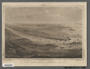
New York and environs : desig…
Proposed site on Staten Islan…
m
Map of the underground railwa…
m
Bridgman's map of the suburbs…
Flushing
m
Driving road chart of the cou…
City guide
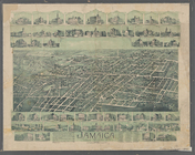
Jamaica, Long Island, N.Y
Bridgman's new map of the Cit…
Grouping of troops and other …
m
Rand McNally & Co.'s road map…
Map showing the proposed area…
Colton's New York City, Brook…
m
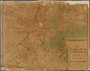
Map of the Passaic and Croton…
Proposed location of the Narr…
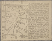
A landmark map of City Hall P…
Map of New York City : showin…
Hagstrom's New York house-num…
m
Financial district map of New…
m
Borough of Manhattan, 300 foo…
m
Map of the metropolitan distr…
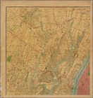
Map of the borough of Manhatt…
Freight terminal map of the P…
New York and environs : desig…
Block no. 86 : confidential r…
Livingston Heights : Livingto…
m
Watson's new map of New York …
m
Watson's new map of New York …
m
Topographical map of New York…
m
Street guide of Manhattan and…
1
2
3
4
5
6
7
8
9
10
…
78
79
Previous
Next
1
2
3
4
5
6
7
8
9
10
…
78
79
Previous
Next