Click to visit the main New York Public Library Homepage
The New York Public Library
Digital Collections
About Digital Collections
Browse
Search only public domain materials
Items
Collections
Divisions
Home
Search
Browse
About
Search only public domain materials
Items
Collections
Divisions
Digital Collections
Using Images
Using Data
Search
Filtered search
Show filters
Hide filters
Show Only Public Domain
topic
Real property
381
Nautical charts
145
Landowners
118
Fire insurance
104
Administrative and political divisions
90
More
Less
name
Perris, William
297
United States Coast Survey
162
Bache, A. D. (Alexander Dallas), 1806-1867
146
Perris & Browne
130
New York (N.Y.). Common Council
88
More
Less
collection
Maps of North America
410
Atlases of New York City
356
Maps of New York City and State
297
Denkmaeler aus Aegypten und Aethiopien nach den Zeichnungen der von seiner Majestat dem Koenige von Preussen Friedrich Wilhelm IV nach diesen Landern gesendeten und in den Jahren 1842-1845 ausgefuhrten wissenschaftlichen Expedition ..
39
Sobranie kart i risunkov k izledovaniam o drevnostiakh IUzhnoi Rossii i beregov Chernago Moria
12
More
Less
place
New York (State)
447
New York
316
Manhattan (New York, N.Y.)
286
New York (N.Y.)
129
Brooklyn (New York, N.Y.)
69
More
Less
genre
Maps
1105
Nautical charts
129
Cadastral maps
100
Prints
66
Bathymetric maps
65
More
Less
publisher
William Perris
142
Perris & Browne
124
U.S. Coast Survey
88
publisher not identified
61
U.S. Coast Survey Office
41
More
Less
division
Map Division
939
General Research Division
54
Rare Book Division
12
Schomburg Jean Blackwell Hutson Research and Reference Division
3
Wallach Division: Print Collection
3
More
Less
type
x
cartographic
still image
39
text
20
Date Range
to
1,148 results found
Filtering on:
x
Date
: 1851 - 1859
x
Type
: cartographic
Sort by:
Title
Date created
Date digitized
Sequence
m
Mercator projection exhibitin…
m
Atlas géologique
m
Map of the city of Brooklyn, …
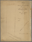
Property in the towns of Cast…
Map of the country thirty-thr…
Map of the country thirty-thr…
Map of the country thirty-thr…
Map of property in the 19th w…
m
Topographical map of New York…
m
Map of the consolidated City …
m
Map of the City of Brooklyn a…
m
Topographical map of the city…
m
Peremptory sale of a suburban…
m
Plan of property situate in t…
Plan of the town of Brooklyn …
Flushing
City guide
m
Plan of the Land in Haverhill…
m
Reynolds' map of modern Londo…
Map of Philadelphia
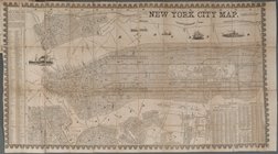
New York City Map
Plan d'ensemble de la cité ou…
Plan d'ensemble de la cité ou…
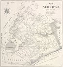
Map of Newtown, Long Island :…
m
Map of the southern part of W…
m
Map of Ulster County, New York
m
Map of Washington County, New…
Maryland in Liberia
A new map of Central America …
Map, Copake (Columbia County,…
Sketch of the public surveys …
Colton's Georgetown and the c…
Phelps's national map of the …
Skeleton map of the overland …
Plan of Charles River and War…
Plan of extension of Devonshi…
Plan of extension of Devonshi…
Map of free states, slave sta…
Geognosticheskaia karta bereg…
Karta rasprostraneniia dreves…
Plan chasti goroda Aiguna
Plan Albazinskago ukrepleniia…
Map of the port & vicinity of…
Plan of the city of Philadelp…
Chengwatana, Pine County, M.T…
Map of the general government…
Chicago harbor
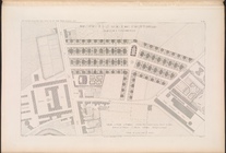
Subdivision of Block 5 of the…
The city of Chicago, Cook Co.…
Geological map of the distric…
1
2
3
4
5
Previous
Next
1
2
3
4
5
Previous
Next