Click to visit the main New York Public Library Homepage
The New York Public Library
Digital Collections
About Digital Collections
Browse
Search only public domain materials
Items
Collections
Divisions
Home
Search
Browse
About
Search only public domain materials
Items
Collections
Divisions
Digital Collections
Using Images
Using Data
Search
Filtered search
Show filters
Hide filters
Show Only Public Domain
topic
Real property
235
Landowners
74
Nautical charts
69
Administrative and political divisions
49
Railroads
40
More
Less
name
Perris, William
193
Perris & Browne
130
United States Coast Survey
72
Bache, A. D. (Alexander Dallas), 1806-1867
69
Lepsius, Richard, 1810-1884
39
More
Less
collection
Atlases of New York City
231
Maps of North America
216
Maps of New York City and State
127
Denkmaeler aus Aegypten und Aethiopien nach den Zeichnungen der von seiner Majestat dem Koenige von Preussen Friedrich Wilhelm IV nach diesen Landern gesendeten und in den Jahren 1842-1845 ausgefuhrten wissenschaftlichen Expedition ..
39
Alʹbom risunkov k puteshestv⁾i︠i︡u na Amur, sovershennomu ot Sibirskago otd︠i︡ela Imperatorskago russkago geograficheskago obshchestva
4
More
Less
place
New York (State)
250
New York
175
Manhattan (New York, N.Y.)
164
Brooklyn (New York, N.Y.)
54
Egypt
40
More
Less
genre
Maps
595
Cadastral maps
67
Nautical charts
59
Prints
49
Bathymetric maps
34
More
Less
publisher
Perris & Browne
124
Nicolaische Buchhandlung
39
Perris & Browne
38
William Perris
38
publisher not identified
34
More
Less
division
Map Division
448
General Research Division
49
Wallach Division: Print Collection
2
Berg Collection
1
Milstein Division
1
More
Less
type
x
cartographic
still image
21
text
13
Date Range
to
633 results found
Filtering on:
x
Date
: 1855 - 1859
x
Type
: cartographic
Sort by:
Title
Date created
Date digitized
Sequence
m
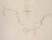
Mercator projection exhibitin…
m
Atlas géologique
Map of the country thirty-thr…
Map of the country thirty-thr…
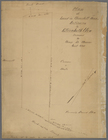
Map of property in the 19th w…
m
Map of the consolidated City …
m
Map of the City of Brooklyn a…
m
Topographical map of the city…
m
Peremptory sale of a suburban…
Plan of the town of Brooklyn …
Flushing
m
Plan of the Land in Haverhill…
m
Reynolds' map of modern Londo…
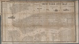
New York City Map
Plan d'ensemble de la cité ou…
Plan d'ensemble de la cité ou…
Colton's Georgetown and the c…
Skeleton map of the overland …
Plan of extension of Devonshi…
Plan of extension of Devonshi…
Map of free states, slave sta…
Geognosticheskaia karta bereg…
Karta rasprostraneniia dreves…
Plan chasti goroda Aiguna
Plan Albazinskago ukrepleniia…
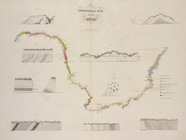
Map of the port & vicinity of…
Chengwatana, Pine County, M.T…
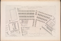
Subdivision of Block 5 of the…
m
Topographical map of the coun…
m
Map of Rockingham Co., New Ha…
Map of the southern part of M…
Sketch of the public surveys …
m
A map of Schuylkill County, P…
Key West Harbor and its appro…
m
Norman's plan of New Orleans …
Map exhibiting the fixed loca…
Kentucky
m
Map of Clinton Co., New York:…
New map of Minnesota : carefu…
Map of the northern peninsula…
m
Chapman's new sectional map o…
Map of Minnesota
Sketch of the public surveys …
Map of the town of Huron, Mic…
Chapman's sectional map of Wi…
Map of Wisconsin showing the …
Norfolk harbor, Virginia : fr…
Topographical map of lands be…
Map of the city of Milwaukee,…
Map of Madison and the Four L…
1
2
3
Previous
Next
1
2
3
Previous
Next