Click to visit the main New York Public Library Homepage
The New York Public Library
Digital Collections
About Digital Collections
Browse
Search only public domain materials
Items
Collections
Divisions
Home
Search
Browse
About
Search only public domain materials
Items
Collections
Divisions
Digital Collections
Using Images
Using Data
Search
Filtered search
Show filters
Hide filters
Show Only Public Domain
topic
Real property
213
Landowners
40
Administrative and political divisions
27
Docks
23
Railroads
20
More
Less
name
Perris & Browne
141
Perris, William
141
Beers, D. G. (Daniel G.)
43
Smith, Robert Pearsall, 1827-1898
15
French, J. H. (John Homer), 1824-1888
9
More
Less
collection
Atlases of New York City
164
Maps of New York City and State
110
Atlases of the United States
42
Maps of North America
2
place
x
New York (State)
New York
189
Manhattan (New York, N.Y.)
143
Jefferson County (N.Y.)
42
New York (N.Y.)
23
More
Less
genre
Maps
318
Atlases
42
Cadastral maps
31
Index maps
6
Title pages
6
More
Less
publisher
Perris & Browne
124
C.K. Stone
42
F. Heppenheimer
23
publisher not identified
12
Perris & Browne
6
More
Less
division
Map Division
188
type
x
cartographic
still image
5
text
5
Date Range
to
318 results found
Filtering on:
x
Date
: 1856 - 1864
x
Place
: New York (State)
x
Type
: cartographic
Sort by:
Title
Date created
Date digitized
Sequence
Plan of the Central Park, Cit…
New York City and environs : …
Map of property in the 19th w…
m
Map of the consolidated City …
Flushing
Colton's railroad & township …
Map of the port & vicinity of…
m
Map of Clinton Co., New York:…
A sketch of the operations of…
Map of the tertiary of Essex …
m
Map of Allegany Co., N.Y.: fr…
m
Map of Dutchess Co., New York…
Map of Brooklyn at the time o…
A map of part of the land in …
m
Topographical map of the stat…
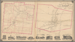
Town & Village of Leroy, Gene…
Town & village of Seneca Fall…
Map of the water pipes in the…
Town of Greenburgh: Westchest…
Atherton, St. Lawrence County…
m
Stony Point and Verplanck's P…
Map of Richland, Oswego Co. N…
m
Map of Suffolk Co., L.I., New…
m
Three maps of the property kn…
Town & village of Ovid, Senec…
Map of the county of Herkimer
Map of Orange County: [New Yo…
Country-seat of Danl. P. Barn…
m
Map of the city of Albany: wi…
m
Map of the village & town of …
Smith's rail road, steam boat…
Map of part of Orange County,…
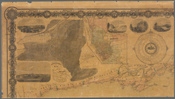
Map of New York, New England,…
m
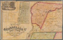
Map of Rensselaer Co., New Yo…
m
Gillette's map of Oneida Co.,…
m
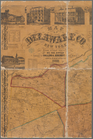
Map of Delaware Co., New York
m
Map of Orange and Rockland Co…
Map of the state of New York …
Map of Livingston Manor anno …
m
Map of Ontario County, New Yo…
Enlargement of the Erie Canal…
Map of part of the village of…
m
Map of the town of Morrisania…
Hempstead
Map of the Albany Rural Cemet…
1863, West Point: [New York]
Map of Sullivan County, New Y…
Middle part of the southern c…
Eastern part of the southern …
m
The State of New York: from n…
1
2
Previous
Next
1
2
Previous
Next