Click to visit the main New York Public Library Homepage
The New York Public Library
Digital Collections
About Digital Collections
Browse
Search only public domain materials
Items
Collections
Divisions
Home
Search
Browse
About
Search only public domain materials
Items
Collections
Divisions
Digital Collections
Using Images
Using Data
Search
Filtered search
Show filters
Hide filters
Show Only Public Domain
topic
Landowners
42
Real property
41
Administrative and political divisions
29
Railroads
20
Canals
10
More
Less
name
Valentine, D. T. (David Thomas), 1801-1869
17
Smith, Robert Pearsall, 1827-1898
14
New York (N.Y.). Common Council
13
French, J. H. (John Homer), 1824-1888
9
Hayward, George, approximately 1800-
9
More
Less
collection
x
Maps of New York City and State
place
New York (State)
110
New York (N.Y.)
34
New York
25
Brooklyn (New York, N.Y.)
24
Manhattan (New York, N.Y.)
19
More
Less
genre
Maps
163
Cadastral maps
31
Manuscript maps
7
Topographic maps
3
Facsimiles
2
More
Less
publisher
publisher not identified
15
The Commissioners
5
H. Phelps
4
M. Dripps
4
Robert Pearsall Smith
4
More
Less
division
Map Division
163
type
x
cartographic
still image
5
Date Range
to
163 results found
Filtering on:
x
Date
: 1856 - 1864
x
Collection
: Maps of New York City and State
x
Type
: cartographic
For more collection details, visit the
Maps of New York City and State collection page
.
Sort by:
Title
Date created
Date digitized
Sequence
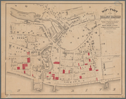
Plan of the Central Park, Cit…
New-York City, County, and vi…
New York City and environs : …
Map of the country thirty-thr…
Map of property in the 19th w…
Map of the city of Brooklyn
m
Map of the consolidated City …
Plan of the town of Brooklyn …
Flushing
Colton's railroad & township …
Map of the port & vicinity of…
m
Map of Clinton Co., New York:…
A sketch of the operations of…
Map of the tertiary of Essex …
m
Map of Allegany Co., N.Y.: fr…
m
Map of Dutchess Co., New York…
Attacks of Fort Washington by…
Attacks of Fort Washington by…
Map of Brooklyn at the time o…
A map of part of the land in …
Town & Village of Leroy, Gene…
Town & village of Seneca Fall…
Map of the water pipes in the…
Town of Greenburgh: Westchest…
Atherton, St. Lawrence County…
m
Stony Point and Verplanck's P…
Map of Richland, Oswego Co. N…
m
Map of Suffolk Co., L.I., New…
m
Three maps of the property kn…
Town & village of Ovid, Senec…
Map of the county of Herkimer
Map of Orange County: [New Yo…
Country-seat of Danl. P. Barn…
m
Map of the city of Albany: wi…
m
Map of the village & town of …
Map of part of Orange County,…
Map of New York, New England,…
m
Map of Rensselaer Co., New Yo…
m
Gillette's map of Oneida Co.,…
m
Map of Delaware Co., New York
m
Map of Orange and Rockland Co…
Map of the state of New York …
Map of Livingston Manor anno …
Map & profile of the Lake Ont…
m
Map of Ontario County, New Yo…
m
Lloyd's topographical map of …
Enlargement of the Erie Canal…
Map of part of the village of…
m
Map of the town of Morrisania…
Hempstead