Click to visit the main New York Public Library Homepage
The New York Public Library
Digital Collections
About Digital Collections
Browse
Search only public domain materials
Items
Collections
Divisions
Home
Search
Browse
About
Search only public domain materials
Items
Collections
Divisions
Digital Collections
Using Images
Using Data
Search
Filtered search
Show filters
Hide filters
Show Only Public Domain
topic
x
Landowners
Real property
64
Administrative and political divisions
24
Cities and towns
17
Villages
11
More
Less
name
Walling, Henry Francis, 1825-1888
14
Smith, Robert Pearsall, 1827-1898
11
H.F. Walling's Map Establishment
9
Beers, S. N
7
Rease, W. H
7
More
Less
collection
Maps of North America
63
Maps of New York City and State
42
place
New York (State)
40
Georgia
14
Pennsylvania
11
New York
9
Cobb County (Ga.)
8
More
Less
genre
Maps
105
Cadastral maps
69
Illustrations
8
Manuscript maps
7
Pictorial works
5
More
Less
publisher
publisher not identified
12
Topographical Engineer's Office
4
producer not identified
4
J.H. French
3
J.H. Higginson
3
More
Less
division
Map Division
105
type
x
cartographic
still image
16
Date Range
to
105 results found
Filtering on:
x
Date
: 1856 - 1864
x
Topic
: Landowners
x
Type
: cartographic
Sort by:
Title
Date created
Date digitized
Sequence
Map of property in the 19th w…
Plan of extension of Devonshi…
Plan of extension of Devonshi…
Map of the port & vicinity of…
m
Chicago
m
Topographical map of the coun…
m
Map of Rockingham Co., New Ha…
m
Map of Clinton Co., New York:…
Map of the city of Milwaukee,…
m
Map of the vicinity of Philad…
m
Map of Allegany Co., N.Y.: fr…
m
Map of Dutchess Co., New York…
m
Map of Lebanon County, Pennsy…
m
Map of Somerset County, Pa.
Map of Venango County oil reg…
Map of Clinton County, Ohio
m
Map of Mahoning County, Ohio …
m
Map of Columbiana County, Ohi…
m
Map of Trumbull County, Ohio
Map of Perry County, Ohio
Map of part of Fauquier Count…
Map of Gloucester, Cape Ann: …
Map of the city of Davenport …
Map of the State of Georgia
m
Map of Vigo County, Indiana
m
Map of Bedford County, Pa.
Map of Washington Co., Pennsy…
Plat of the town of Elmhurst,…
m
Topographical map of the Coun…
m
Map of Cook County, Illinois
Lloyd's map of the Great Oil …
Lloyd's map of the Great Oil …
Map of Venango County, Pennsy…
Map of the oil region, Venang…
A map of part of the land in …
Map of the Parish of Winn, Lo…
Map of Northumberland County,…
Map of the Parish of Carroll,…
Map of Bennington County, Ver…
m
Map of Essex County, New Jers…
m
New map of Burlington County:…
m
Map of the city of Newark, N.…
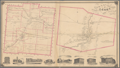
Town & Village of Leroy, Gene…
Town & village of Seneca Fall…
Town of Greenburgh: Westchest…
Atherton, St. Lawrence County…
Map of Richland, Oswego Co. N…
m
Topographical map of Union Co…
m
Map of the counties of Bergen…
Map of Waldo County, Maine: f…