Click to visit the main New York Public Library Homepage
The New York Public Library
Digital Collections
About Digital Collections
Browse
Search only public domain materials
Items
Collections
Divisions
Home
Search
Browse
About
Search only public domain materials
Items
Collections
Divisions
Digital Collections
Using Images
Using Data
Search
Filtered search
Show filters
Hide filters
Show Only Public Domain
topic
Real property
262
History
119
Landowners
105
Administrative and political divisions
90
Nautical charts
82
More
Less
name
Perris, William
142
Perris & Browne
141
United States Coast Survey
106
Bache, A. D. (Alexander Dallas), 1806-1867
85
Mitchell, S. Augustus (Samuel Augustus), 1792-1868
50
More
Less
collection
Maps of North America
484
Atlases of New York City
196
Maps of New York City and State
163
Atlases, gazetteers, guidebooks and other books
52
Atlases of the United States
42
More
Less
place
New York (State)
318
New York
189
Manhattan (New York, N.Y.)
152
United States
111
Virginia
89
More
Less
genre
Maps
963
Cadastral maps
85
Nautical charts
71
Prints
49
Bathymetric maps
43
More
Less
publisher
Perris & Browne
124
publisher not identified
65
S. A. Mitchell, jr
49
U.S. Coast Survey
46
C.K. Stone
42
More
Less
division
Map Division
810
General Research Division
46
Wallach Division: Print Collection
4
Schomburg Jean Blackwell Hutson Research and Reference Division
3
Schomburg Manuscripts, Archives and Rare Books Division
3
More
Less
type
x
cartographic
still image
25
text
16
Date Range
to
1,000 results found
Filtering on:
x
Date
: 1856 - 1864
x
Type
: cartographic
Sort by:
Title
Date created
Date digitized
Sequence
A carefully prepared map of t…
Information map of part of Ge…
m
Map of Richmond, Virginia : s…
The army map of Georgia
Map of part of the Shenandoah…
Plan of South Bay: showing ch…
Lynn Harbor, Massachusetts 18…
Johnson's United States
Information map, Hd. Qrs, 20t…
Johnson's Iowa and Nebraska
Map of the battlefield of Ant…
Itineraire aux mines de la Ne…
Map of part of Colorado Terri…
Geological and topographical …
Plan for the occupation of th…
Map of the oil district of We…
Johnson's Indiana
Part of Cobb County, Georgia
Part of Paulding County, Geor…
Part of Paulding County, Geor…
Map of first district, Campbe…
Part of northern Georgia
Part of Cobb Co., Ga
Part of northern Georgia: no.…
Map of the oil regions of wes…
Map of explorations and surve…
The Cornplanters Reserve, Ven…
New York and vicinity
m
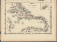
Johnson's West Indies, Plate …
Military topographical map of…
Manuscript map of Civil War t…
Military map of south-eastern…
m
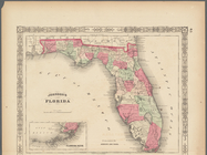
Johnson's Florida, Plate 43
The Course of the River Cali …
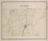
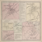
Antwerp. [Township]
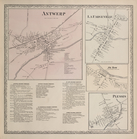
Antwerp [Village]; La Fargevi…
Pillar Point P.O. [Village]; …
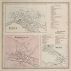
Dexter. [Village]; Dexter Bus…
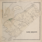
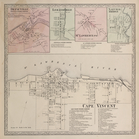
Cape Vincent [Township]
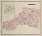
Depauville [Village]; Leraysv…
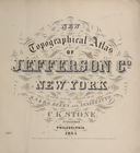
New topographical atlas of Je…
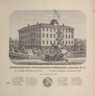
Hungerford Collegiate Institu…
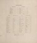
Index.
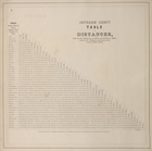
Jefferson County. Table of Di…
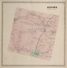
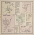
Adams. [Township]
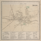
Adams [Village]; Adams Busine…
Ellisburgh P.O. ( Ellisvillag…
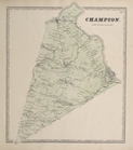
Champion. [Township]
Evans Mills [Village]; Philad…
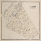
Clayton [Township]
1
2
3
4
Previous
Next
1
2
3
4
Previous
Next