Click to visit the main New York Public Library Homepage
The New York Public Library
Digital Collections
About Digital Collections
Browse
Search only public domain materials
Items
Collections
Divisions
Home
Search
Browse
About
Search only public domain materials
Items
Collections
Divisions
Digital Collections
Using Images
Using Data
Search
Filtered search
Show filters
Hide filters
Show Only Public Domain
topic
Real property
262
History
119
Landowners
105
Administrative and political divisions
90
Nautical charts
82
More
Less
name
Perris, William
142
Perris & Browne
141
United States Coast Survey
106
Bache, A. D. (Alexander Dallas), 1806-1867
85
Mitchell, S. Augustus (Samuel Augustus), 1792-1868
50
More
Less
collection
Maps of North America
484
Atlases of New York City
196
Maps of New York City and State
163
Atlases, gazetteers, guidebooks and other books
52
Atlases of the United States
42
More
Less
place
New York (State)
318
New York
189
Manhattan (New York, N.Y.)
152
United States
111
Virginia
89
More
Less
genre
Maps
963
Cadastral maps
85
Nautical charts
71
Prints
49
Bathymetric maps
43
More
Less
publisher
Perris & Browne
124
publisher not identified
65
S. A. Mitchell, jr
49
U.S. Coast Survey
46
C.K. Stone
42
More
Less
division
Map Division
810
General Research Division
46
Wallach Division: Print Collection
4
Schomburg Jean Blackwell Hutson Research and Reference Division
3
Schomburg Manuscripts, Archives and Rare Books Division
3
More
Less
type
x
cartographic
still image
25
text
16
Date Range
to
1,000 results found
Filtering on:
x
Date
: 1856 - 1864
x
Type
: cartographic
Sort by:
Title
Date created
Date digitized
Sequence
m
Nuevo mapa topográfico de la …
Plan of the Central Park, Cit…
Map illustrating the operatio…
Das freie und das Sklaverei-G…
m
Mercator projection exhibitin…
New-York City, County, and vi…
New York City and environs : …
Map of the country thirty-thr…
Map of property in the 19th w…
Map of the city of Brooklyn
m
Map of the consolidated City …
Plan of the town of Brooklyn …
Flushing
m
Plan of the Land in Haverhill…
m
Reynolds' map of modern Londo…
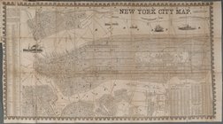
New York City Map
Colton's railroad & township …
Survey of St. Mary's Church L…
Map of Wisconsin designed to …
Plan of Public Garden: showin…
Skeleton map of the overland …
Plan of extension of Devonshi…
Plan of extension of Devonshi…
Plan of South Bay: showing ch…
Plan for the occupation of th…
Map of free states, slave sta…
Geognosticheskaia karta bereg…
Karta rasprostraneniia dreves…
Plan chasti goroda Aiguna
Plan Albazinskago ukrepleniia…
Map of the port & vicinity of…
Chengwatana, Pine County, M.T…
m
Chicago
Subdivision of Block 5 of the…
Johnson's Indiana
m
Topographical map of the coun…
m
Map of Rockingham Co., New Ha…
Map of the southern part of M…
Sketch of the public surveys …
Johnson's Wisconsin and Michi…
Sketch of the public surveys …
m
Norman's plan of New Orleans …
Map exhibiting the fixed loca…
Kentucky
m
Map of Clinton Co., New York:…
Sketch of the public surveys …
New map of Minnesota : carefu…
m
Map of the States of Michigan…
Geological and topographical …
Map of the northern peninsula…
1
2
3
4
Previous
Next
1
2
3
4
Previous
Next