Click to visit the main New York Public Library Homepage
The New York Public Library
Digital Collections
About Digital Collections
Browse
Search only public domain materials
Items
Collections
Divisions
Home
Search
Browse
About
Search only public domain materials
Items
Collections
Divisions
Digital Collections
Using Images
Using Data
Search
Filtered search
Show filters
Hide filters
Show Only Public Domain
topic
Real property
147
Landowners
14
Nautical charts
13
Administrative and political divisions
10
Railroads
9
More
Less
name
Perris & Browne
130
Perris, William
130
Bache, A. D. (Alexander Dallas), 1806-1867
14
United States Coast Survey
14
Smith, M. L. (Martin Luther), 1819-1866
8
More
Less
collection
Atlases of New York City
162
Maps of North America
44
Maps of New York City and State
30
American slavery and colour
1
Atlases, gazetteers, guidebooks and other books
1
More
Less
place
New York (State)
148
Manhattan (New York, N.Y.)
133
New York
133
Massachusetts
9
United States
9
More
Less
genre
Maps
239
Cadastral maps
11
Nautical charts
10
Index maps
7
Title pages
7
More
Less
publisher
Perris & Browne
124
Perris & Browne
38
publisher not identified
9
U.S. Coast Survey Office
6
The Commissioners
5
More
Less
division
Map Division
108
Schomburg Manuscripts, Archives and Rare Books Division
1
type
x
cartographic
text
8
still image
3
Date Range
to
239 results found
Filtering on:
x
Date
: 1857 - 1857
x
Type
: cartographic
Sort by:
Title
Date created
Date digitized
Sequence
Map of the Butterfield Overla…
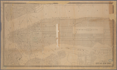
Map of the city of New York, …
Map of Venango County, Pennsy…
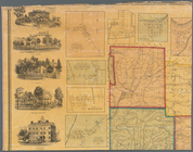
Town of Greenburgh: Westchest…
Skeleton map of the overland …
Norfolk harbor, Virginia : fr…
Plan of the cemetery of Mount…
Plan of Boston comprising a p…
m
A topographical map of Lincol…
Preliminary chart of Frying P…
Boston Harbor, Massachusetts
m
Mitchell's new national map e…
Diagram showing the relative …
Preliminary chart no. 4 of th…
m
Map of the territory of the U…
Chengwatana, Pine County, M.T…
Map of the city of Davenport …
Plan of extension of Devonshi…
Map & profile of the Lake Ont…
m
Map of Tolland County, Connec…
Grand Island Pass, Mississipp…
The harbor of Wood's Hole, Ma…
m
A sectional map of Iowa
Preliminary chart of Rappahan…
m
Schuyler County, New York, wi…
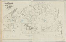
Map of free states, slave sta…
Map of the territory of the U…
Map bounded by West 42nd Stre…
Map bounded by West 47th Stre…
Map bounded by West 47th Stre…
Map bounded by West 47th Stre…
Map bounded by West 52nd Stre…
Map bounded by West 52nd Stre…
Map bounded by West 52nd Stre…
Map bounded by West 57th Stre…
Map bounded by West 57th Stre…
Map bounded by West 57th Stre…
Map bounded by West 57th Stre…
Map bounded by East 57th Stre…
Map bounded by East 57th Stre…
Map bounded by East 62nd Stre…
Map bounded by East 62nd Stre…
Map bounded by East 62nd Stre…
Map bounded by West 59th Stre…
Map bounded by West 62nd Stre…
Map bounded by West 64th Stre…
Map bounded by West 72nd Stre…
Map bounded by West 67th Stre…
Map bounded by West 72nd Stre…
Map bounded by East 67th Stre…