Click to visit the main New York Public Library Homepage
The New York Public Library
Digital Collections
About Digital Collections
Browse
Search only public domain materials
Items
Collections
Divisions
Home
Search
Browse
About
Search only public domain materials
Items
Collections
Divisions
Digital Collections
Using Images
Using Data
Search
Filtered search
Show filters
Hide filters
Show Only Public Domain
topic
Administrative and political divisions
56
Landowners
47
Real property
47
Railroads
46
Ferries
20
More
Less
name
Dripps, M. (Matthew)
19
Valentine, D. T. (David Thomas), 1801-1869
17
New York (N.Y.). Common Council
14
Hayward, George, approximately 1800-
11
Smith, Robert Pearsall, 1827-1898
10
More
Less
collection
x
Maps of New York City and State
place
New York (State)
158
New York (N.Y.)
64
New York
51
Brooklyn (New York, N.Y.)
48
Manhattan (New York, N.Y.)
37
More
Less
genre
Maps
233
Cadastral maps
33
Manuscript maps
11
Topographic maps
5
Facsimiles
3
More
Less
publisher
publisher not identified
24
M. Dripps
11
G.W. & C.B. Colton & Co
7
A. Brown & Co
5
The Commissioners
5
More
Less
division
Map Division
232
Manuscripts and Archives Division
1
type
x
cartographic
still image
4
text
1
Date Range
to
233 results found
Filtering on:
x
Date
: 1857 - 1869
x
Collection
: Maps of New York City and State
x
Type
: cartographic
For more collection details, visit the
Maps of New York City and State collection page
.
Sort by:
Title
Date created
Date digitized
Sequence
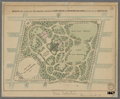
Plan of the Central Park, Cit…
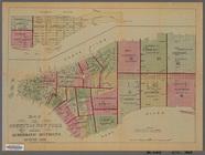
New-York City, County, and vi…
Map of the country thirty thr…
Map of New York and vicinity …
Map of the country thirty thr…
New-York and vicinity as prop…
New York City and environs : …
Map of the country thirty-thr…
Map of the County of New York…
m
Sanitary & topographical map …
Map of property in the 19th w…
Design for laying out the gro…
Map of the county of Kings, s…
Watson's new map of the city …
Map of the city of Brooklyn
m
Map of the consolidated City …
Plan of the town of Brooklyn …
New York and environs : desig…
Flushing
New York and environs : desig…
m
Map of the City of New York a…
Colton's railroad & township …
Map of the state of New York:…
Map of the rail-roads of the …
Map of the port & vicinity of…
A sketch of the operations of…
Map of the tertiary of Essex …
m
Map of Dutchess Co., New York…
Colton's railroad & township …
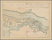
Attacks of Fort Washington by…
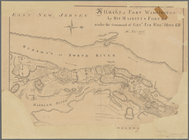
Attacks of Fort Washington by…
Map of Brooklyn at the time o…
A map of part of the land in …
Map of Long Island: showing t…
m
Asher & Adams' new topographi…
Map of the water pipes in the…
Town of Greenburgh: Westchest…
Atherton, St. Lawrence County…
m
Stony Point and Verplanck's P…
Map of Richland, Oswego Co. N…
m
Map of Suffolk Co., L.I., New…
Map of lands in the town of Y…
m
Three maps of the property kn…
Town & village of Ovid, Senec…
Map of Rockland Co: [New York]
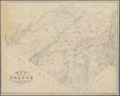
Map of Orange County: [New Yo…
Country-seat of Danl. P. Barn…
m
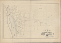
Map of the city of Albany: wi…
m
Map of the City of Utica, One…
Map of part of Orange County,…