Click to visit the main New York Public Library Homepage
The New York Public Library
Digital Collections
About Digital Collections
Browse
Search only public domain materials
Items
Collections
Divisions
Home
Search
Browse
About
Search only public domain materials
Items
Collections
Divisions
Digital Collections
Using Images
Using Data
Search
Filtered search
Show filters
Hide filters
Show Only Public Domain
topic
Real property
855
Business enterprises
469
History
98
Administrative and political divisions
82
Railroads
75
More
Less
name
Beers, F. W. (Frederick W.)
227
Beers, D. G. (Daniel G.)
144
D.G. Beers & Co
130
Beers, S. N
121
J.B. Beers & Co
115
More
Less
collection
Atlases of the United States
875
Maps of New York City and State
266
Atlases of New York City
58
Maps of North America
6
place
x
New York (State)
New York
133
Orange County
93
Orange County (N.Y.)
93
New York (N.Y.)
89
More
Less
genre
Maps
1037
Atlases
875
Prints
70
Cadastral maps
49
Manuscript maps
19
More
Less
publisher
Andreas, Baskin & Burr
90
Stone & Stewart
70
Walker & Jewett
63
D.G. Beers
55
Beers, Upton & Co
46
More
Less
division
x
Map Division
type
cartographic
1105
text
114
still image
6
Date Range
to
1,205 results found
Filtering on:
x
Date
: 1858 - 1875
x
Division
: Map Division
x
Place
: New York (State)
Sort by:
Title
Date created
Date digitized
Sequence
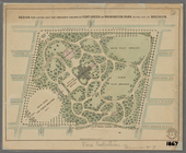
Plan of the Central Park, Cit…
Saratoga Springs [Township]
Schuylerville Business Direct…
Saratoga [Township]
Stillwater [Township]
References; Waterford [Villag…
Waterford [Township]
Beechers Hollow [Village]; Be…
Wilton [Township]
Map of Saratoga County
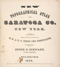
New topographical atlas of Sa…
Residence of James Carrigan, …
Index
Acres of Land, Population, Dw…
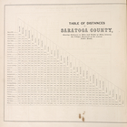
Table of Distances in Saratog…
Ballston [Township]
Ballston Spa Business Directo…
Charlton [Township]
Grangerville [Village]; Grang…
Clifton Park [Township]
Corinth [Township]; Palmer Fa…
Clifton Park [Village]; Clift…
Day Corners Business Director…
Edinburgh [Township]
Crescent [Village]; Crescent …
Galway [Township]; Yorks Corn…
Greenfield [Township]; Pages …
Bloodville [Village]; Bloodvi…
Hadley [Township]; Hadley Bus…
Half Moon [Township]
Factory Village [Village]; Fa…
Malta [Township]
Burnt Hills [Village]; Burnt …
Milton [Township]
Moreau [Township]
Conklingville [Village]; Conk…
Northumberland [Township]
Providence [Township]; Hagedo…
References; Saratoga Springs …
Map showing location of lands…
Map of the country thirty thr…
Map of the country thirty thr…
Map of New York and vicinity …
Map of the country thirty thr…
New-York and vicinity as prop…
New York City and environs : …
m
Sanitary & topographical map …
Design for laying out the gro…
m
Map of the city of Brooklyn
m
Map of the consolidated City …
1
2
3
4
5
Previous
Next
1
2
3
4
5
Previous
Next