Click to visit the main New York Public Library Homepage
The New York Public Library
Digital Collections
About Digital Collections
Browse
Search only public domain materials
Items
Collections
Divisions
Home
Search
Browse
About
Search only public domain materials
Items
Collections
Divisions
Digital Collections
Using Images
Using Data
Search
Filtered search
Show filters
Hide filters
Show Only Public Domain
topic
Colonization
7
Discovery and exploration
6
History
5
Slavery
5
African Americans
4
More
Less
name
Bartholomew, J. G. (John George), 1860-1920
6
Johnston, Harry Hamilton, Sir, 1858-1927
6
Faidherbe, Louis Léon César, 1818-1889
2
Jay, E. A. Hastings (Edward Aubrey Hastings)
2
Royal Geographical Society (Great Britain)
2
More
Less
collection
Liberia
8
A history of the colonization of Africa by alien races
6
The lure of Africa
4
George Grenfell and the Congo: a history and description of the Congo Independent State and adjoining districts of Congoland, Volume 1
3
A glimpse of the tropics; or, Four months cruising in the West Indies
2
More
Less
place
Africa
21
Liberia
9
United States
4
Maps
3
Southern States
3
More
Less
genre
x
Maps
Illustrations
15
Photographs
2
statistics
2
Statistics
1
publisher
Hutchinson & Co
11
University Press
6
s.n
5
Missionary education movement of the United States and Canada
4
Hachette et cie
2
More
Less
division
x
Schomburg Jean Blackwell Hutson Research and Reference Division
type
cartographic
63
text
3
still image
1
Date Range
to
64 results found
Filtering on:
x
Date
: 1858 - 1925
x
Division
: Schomburg Jean Blackwell Hutson Research and Reference Division
x
Genre
: Maps
Sort by:
Title
Date created
Date digitized
Sequence
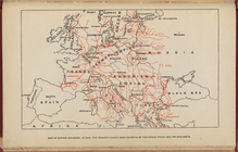
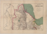
Map of Europe, showing in Red…
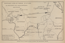
Proposed lines of Mission sta…
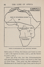
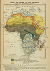
Zones of Mohammedan and Chris…
Johannesburg―the Hub of South…
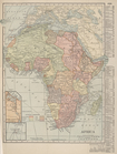
Africa
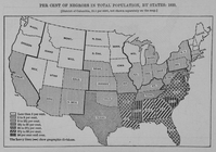
Per cent of Negroes in total …
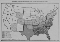
Percentage of Negroes in the …
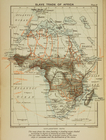
Slave trade map of equatorial…
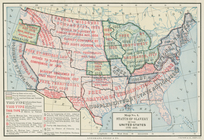
Status of slavery in the Unit…
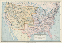
The United States, March 4, 1…
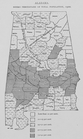
Alabama. Negro percentage of …
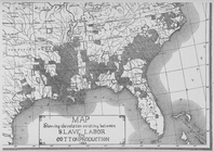
Map showing the relation exis…
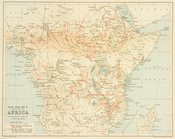
Treaty map of Africa
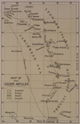
Map of the Lesser Antilles
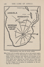
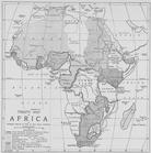
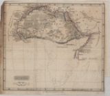
Map of Africa
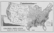
Colored population ratio to t…
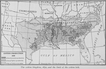
The cotton kingdom, 1850, and…
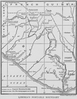
Liberia's portable boundary
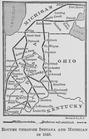
Routes through Indiana and Mi…
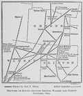
Network of routes through Gre…
Jamaica
Map of the North Atlantic Oce…
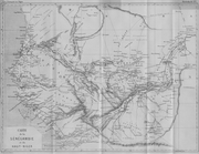
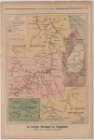
Carte de la Sénégambie et du …
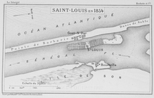
Saint - Louis en 1854
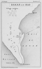
Dakar en 1850
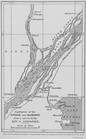
Confluence of the Congo and M…
Stanley's general idea of the…
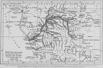
Sketch Map showing the princi…
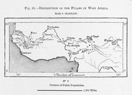
Distribution of Fulahs in Wes…
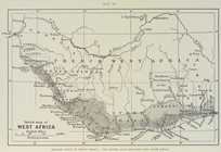
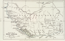
Sketch map of West Africa : s…
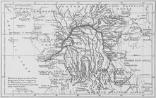
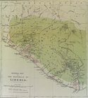
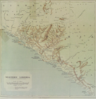
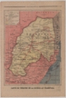
General map of the Republic o…
Sketch map of West Africa
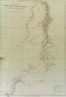
Map of the Sierra Leone - Lib…
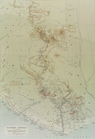
Western Liberia
Eastern Liberia
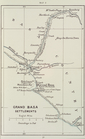
Grand Basa settlements
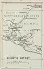
Monrovia district
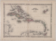
Johnson's West Indies
Africa
Africa as known to the Ancien…
Muhammadan Africa
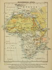
Slave trade of Africa
French Africa
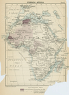
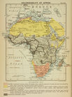
Colonizability of Africa
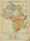
Political Africa - 1898
Countries in the northern tro…
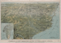
Stannard and Son's perspectiv…
Dominii e protettorati italia…
La mission Marchand et l'Angl…
Carte du théatre de la guerre…