Click to visit the main New York Public Library Homepage
The New York Public Library
Digital Collections
About Digital Collections
Browse
Search only public domain materials
Items
Collections
Divisions
Home
Search
Browse
About
Search only public domain materials
Items
Collections
Divisions
Digital Collections
Using Images
Using Data
Search
Filtered search
Show filters
Hide filters
Show Only Public Domain
topic
Real property
9459
Fire insurance
5184
Cities & towns
4997
Administrative and political divisions
668
Railroads
656
More
Less
name
Sanborn Map Company
5090
G.W. Bromley & Co
1711
Bromley, George Washington
830
Bromley, Walter Scott
830
Austro-Hungarian Monarchy. Militärgeographisches Institut
773
More
Less
collection
Atlases of New York City
9157
Atlases of the United States
3391
Maps of North America
1997
Maps of New York City and State
1376
Spezialkarte der Osterreichisch-Ungarischen Monarchie
773
More
Less
place
New York (State)
10353
New York
3108
Manhattan (New York, N.Y.)
1471
New York (N.Y.)
1317
Brooklyn (New York, N.Y.)
1054
More
Less
genre
x
Maps
Atlases
3342
Topographic maps
1014
Cadastral maps
426
Plans
96
More
Less
publisher
Sanborn Map Company
5126
G.W. Bromley & Co
1533
K.u.K. Militargeographisches Institut
773
E. Belcher Hyde
768
E. Robinson Co
332
More
Less
division
Map Division
16704
General Research Division
189
Manuscripts and Archives Division
72
Schomburg Jean Blackwell Hutson Research and Reference Division
64
Milstein Division
33
More
Less
type
cartographic
17173
text
239
still image
149
Date Range
to
17,266 results found
Filtering on:
x
Date
: 1858 - 1925
x
Genre
: Maps
Sort by:
Title
Date created
Date digitized
Sequence
m
Nuevo mapa topográfico de la …
m
Map of the Cedar Knolls, at B…
m
Mapah derekh emet : Mapa Dere…
An old map of Heijokyo (Heijo…
An old map of Heiankyo (Heian…
Paris, ses monuments : guide …
Plan of the Central Park, Cit…
Map of Camp Chase. Drawn on a…
Map illustrating the operatio…
Saratoga Springs [Township]
Schuylerville Business Direct…
Saratoga [Township]
Stillwater [Township]
References; Waterford [Villag…
Waterford [Township]
Beechers Hollow [Village]; Be…
Wilton [Township]
Map of Saratoga County
Ballston [Township]
Ballston Spa Business Directo…
Charlton [Township]
Grangerville [Village]; Grang…
Clifton Park [Township]
Corinth [Township]; Palmer Fa…
Clifton Park [Village]; Clift…
Day Corners Business Director…
Edinburgh [Township]
Crescent [Village]; Crescent …
Galway [Township]; Yorks Corn…
Greenfield [Township]; Pages …
Bloodville [Village]; Bloodvi…
Hadley [Township]; Hadley Bus…
Half Moon [Township]
Factory Village [Village]; Fa…
Malta [Township]
Burnt Hills [Village]; Burnt …
Milton [Township]
Moreau [Township]
Conklingville [Village]; Conk…
Northumberland [Township]
Providence [Township]; Hagedo…
References; Saratoga Springs …
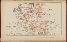
Map of Europe, showing in Red…
Map of the borough of Brookly…
m
Johnson's Physical Map
England & Wales
Zoological chart of the world…
m
Chart of the world exhibiting…
Das freie und das Sklaverei-G…
The Jeannette ; Lost In the I…
1
2
3
4
5
6
7
8
9
10
…
69
70
Previous
Next
1
2
3
4
5
6
7
8
9
10
…
69
70
Previous
Next