Click to visit the main New York Public Library Homepage
The New York Public Library
Digital Collections
About Digital Collections
Browse
Search only public domain materials
Items
Collections
Divisions
Home
Search
Browse
About
Search only public domain materials
Items
Collections
Divisions
Digital Collections
Using Images
Using Data
Search
Filtered search
Show filters
Hide filters
Show Only Public Domain
topic
History
24
Administrative and political divisions
12
Insurance
11
Warehouses
11
Nautical charts
9
More
Less
name
United States Coast Survey
15
American Civil War (1861-1865)
13
Perris & Browne
11
Perris, William
11
Bache, A. D. (Alexander Dallas), 1806-1867
10
More
Less
collection
Maps of North America
75
Atlases of New York City
11
Maps of New York City and State
7
Geschichte der Sklaverei in den Vereinigten Staaten von Amerika
1
I. N. Phelps Stokes Collection of American Historical Prints
1
More
Less
place
United States
21
New York (State)
15
Brooklyn (New York, N.Y.)
13
Virginia
12
New York
11
More
Less
genre
Maps
96
Nautical charts
8
Bathymetric maps
7
Military maps
6
Cadastral maps
2
More
Less
publisher
U.S. Coast Survey Office
7
Surveyor General's Office
6
publisher not identified
5
U.S. Coast Survey
4
Army of the Potomac
3
More
Less
division
Map Division
93
Schomburg Jean Blackwell Hutson Research and Reference Division
1
Schomburg Manuscripts, Archives and Rare Books Division
1
Wallach Division: Print Collection
1
type
x
cartographic
still image
1
text
1
Date Range
to
96 results found
Filtering on:
x
Date
: 1861 - 1861
x
Type
: cartographic
Sort by:
Title
Date created
Date digitized
Sequence
Das freie und das Sklaverei-G…
Sketch of the public surveys …
Sketch of the public surveys …
m
Map of the States of Michigan…
m
Map of the vicinity of Philad…
Map showing the progress of t…
Map of Kansas and Nebraska : …
Map of Colorado territory : c…
J.H. Colton's topographical m…
Map of a part of Washington T…
Map of a part of Washington T…
Preliminary Chart of entrance…
Reconnaissance of entrance & …
A diagram of Oregon
Map showing the routes travel…
Map of the canals and rail ro…
m
Frederick County, Maryland: p…
m
Washington County, Maryland: …
Map of part of Virginia, Mary…
Map of Virginia : showing the…
Map of Virginia showing the d…
Map of public surveys in Cali…
Preliminary chart of Tomales …
Sketch of public surveys in N…
Petaluma and Napa Creeks, Cal…
Lloyd's official map of Misso…
The key to East Virginia : sh…
Sketch showing route of gener…
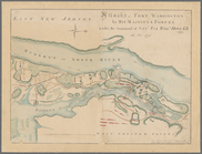
Attacks of Fort Washington by…
Rappahannock River, Virginia …
Loudon County, Virginia
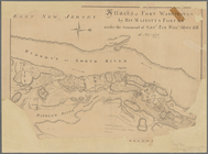
Attacks of Fort Washington by…
Middle Virginia and North Car…
Military map of south-eastern…
Sketch of the public surveys …
Sketch of the Atlantic coast …
Pictorial map of the seat of …
m
Map of part of Virginia, Mary…
m
Map of Bedford County, Pa.
Map of Washington Co., Pennsy…
Fortifications of Charleston …
Sketch of Beaufort, Port Roya…
Map of the Sea-Coast of South…
Colton's map of Virginia, Mar…
Lloyd's official map of the s…
St. Helena Sound, South Carol…
Berkeley County, Virginia
Sketch of the coast of North …
Strategic war points of the U…
Sketch showing the positions …