Click to visit the main New York Public Library Homepage
The New York Public Library
Digital Collections
About Digital Collections
Browse
Search only public domain materials
Items
Collections
Divisions
Home
Search
Browse
About
Search only public domain materials
Items
Collections
Divisions
Digital Collections
Using Images
Using Data
Search
Filtered search
Show filters
Hide filters
Show Only Public Domain
topic
Landowners
40
Real property
32
Railroads
5
Administrative and political divisions
4
Oil fields
3
More
Less
name
United States. Army. Dept. of the Cumberland. Topographical Engineers
6
Beers, F. W. (Frederick W.)
4
United States. Army. Corps of Topographical Engineers
4
Worley & Bracher
4
Bourquin, F. (Frederick), 1808-
3
More
Less
collection
Maps of North America
40
Maps of New York City and State
9
place
Georgia
12
Pennsylvania
12
Cobb County (Ga.)
8
New York (State)
8
Connecticut
4
More
Less
genre
x
Cadastral maps
Maps
49
Manuscript maps
9
Topographic maps
4
Charts
2
More
Less
publisher
publisher not identified
9
Topographical Engineer's Office
4
producer not identified
3
A. Pomeroy
2
Lith. of Jones & Newman
2
More
Less
division
Map Division
49
type
cartographic
49
still image
1
Date Range
to
49 results found
Filtering on:
x
Date
: 1863 - 1869
x
Genre
: Cadastral maps
Sort by:
Title
Date created
Date digitized
Sequence
m
Chicago
Map of the survey of Wissahic…
Lots & blocks shaded red belo…
The Cornplanters Reserve, Ven…
General plan of Riverside : […
Map of Warren County, Pennsyl…
Map of Venango County oil reg…
Railroad map of the City of S…
Railroad map of the City of S…
m
Map of Clearfield Co., Pennsy…
m
Map of Cambria Co., Pennsylva…
Plat of the town of Elmhurst,…
Lands of the Tremont Petroleu…
m
Title map of the coal field o…
Map of West Hickory Creek, Ve…
Plan of President Township
Lloyd's map of the Great Oil …
Lloyd's map of the Great Oil …
Map of the oil region, Venang…
m
Highwood Park, East of Glenwo…
m
Asher & Adams' new topographi…
Map of building lots, on the …
m
Map of the city of Boston and…
Map of lands in the town of Y…
Plan of Suffolk Street Distri…
Plan of Church St. district: …
Map of Rockland Co: [New York]
m
Map of the City of Utica, One…
m
Map of Clasons Point: in the …
Plan of Danbury, Fairfield Co…
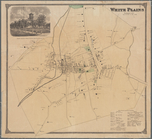
White Plains, Westchester Co.…
The principal parts of Norwal…
The principal parts of Norwal…
Town of Bethel, Fairfield Co.…
Information map, Hd. Qrs. 20 …
Information map, Hd. Qrs, 20t…
Part of Cobb Co., Ga
Information map of part of Ge…
Part of Cobb County, Georgia
Map of first district, Campbe…
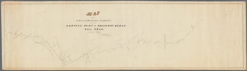
Map of a preliminary survey f…
m
Position Army Cumbld., June 2…
Information map only, H. Qrs.…
Manuscript map of the area we…
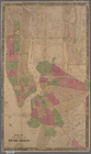
Map of the cities of New York…
m
Map of Kings County N.Y.
Part of Paulding County, Geor…
Part of Paulding County, Geor…
Part of Cobb Co., Ga
End of results
|
Top