Click to visit the main New York Public Library Homepage
The New York Public Library
Digital Collections
About Digital Collections
Browse
Search only public domain materials
Items
Collections
Divisions
Home
Search
Browse
About
Search only public domain materials
Items
Collections
Divisions
Digital Collections
Using Images
Using Data
Search
Filtered search
Show filters
Hide filters
Show Only Public Domain
topic
Real property
423
Business enterprises
166
Administrative and political divisions
89
History
86
Railroads
85
More
Less
name
Beers, F. W. (Frederick W.)
169
Beers, S. N
130
Beers, D. G. (Daniel G.)
127
Stone & Stewart
125
Mitchell, S. Augustus (Samuel Augustus), 1792-1868
51
More
Less
collection
Atlases of the United States
497
Maps of North America
280
Atlases of New York City
144
Maps of New York City and State
116
Atlases, gazetteers, guidebooks and other books
52
More
Less
place
New York (State)
429
United States
64
Brooklyn (New York, N.Y.)
63
New York Metropolitan Area
59
New York
56
More
Less
genre
x
Maps
Atlases
497
Cadastral maps
49
Manuscript maps
25
Illustrations
13
More
Less
publisher
Stone & Stewart
83
S. A. Mitchell, jr
50
F. W. Beers, A. D. Ellis & others
49
Beers, Ellis & Soule
42
C.K. Stone
42
More
Less
division
Map Division
1089
Rare Book Division
14
General Research Division
8
Manuscripts and Archives Division
4
Schomburg Manuscripts, Archives and Rare Books Division
3
More
Less
type
cartographic
1116
text
22
still image
17
Date Range
to
1,123 results found
Filtering on:
x
Date
: 1863 - 1869
x
Genre
: Maps
Sort by:
Title
Date created
Date digitized
Sequence
Results 251 - 300
The United States, southern p…
Plan for the occupation of fl…
Sketch of The Narrows in Bost…
Map showing the routes traver…
Map of the Southern States, i…
Plan of Boston and its vicini…
New map of Boston: comprising…
Map of park: as proposed by U…
No. II, changes in the bed of…
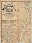
Topographical map of the stat…
Map of the oil regions of Ven…
Map of the Washington aqueduc…
Map of Boston and the country…
Plan of the western seat of w…
Map of Boston and vicinity: e…
m
Map of the city of Boston and…
Boston Harbor, Massachusetts:…
Railway map of the New Englan…
Mail and passenger route from…
m
National map of the territory…
m
National map of the territory…
Johnson's California, also Ut…
Johnson's Arkansas, Mississip…
Map of the oil regions of wes…
Map of Castle Hill & Price's …
The early purchasers of Hills…
Map of lands in the town of Y…
m
Three maps of the property kn…
Plan of Suffolk Street Distri…
Map of the seat of war to acc…
Extract from a map entitled P…
Plan of Church St. district: …
Plan of Boston
Plan of Boston: corrected und…
Map of Rockland Co: [New York]
m
Schonberg's imperial map of t…
m
H.H. Lloyd & Co.'s new Union …
m
Map of the City of Utica, One…
Reconnaissance of the western…
Reconnaissance of the western…
Historical map of Nantucket
Map of Cambridge, Mass.
m
National map of the territory…
m
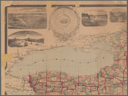
New map of the state of New Y…
m
Lloyd's topographical map of …
Map of the Nipmuck or Nipnet …
Map of the territory of the U…
Territory of the United State…
[Map of eastern Cape Cod, Mas…
m
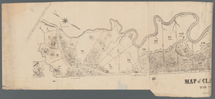
Map of Clasons Point: in the …
1
2
3
4
5
Previous
Next
1
2
3
4
5
Previous
Next