Click to visit the main New York Public Library Homepage
The New York Public Library
Digital Collections
About Digital Collections
Browse
Search only public domain materials
Items
Collections
Divisions
Home
Search
Browse
About
Search only public domain materials
Items
Collections
Divisions
Digital Collections
Using Images
Using Data
Search
Filtered search
Show filters
Hide filters
Show Only Public Domain
topic
Real property
138
Business enterprises
79
Fire insurance
32
Administrative and political divisions
28
Railroads
26
More
Less
name
Beers, S. N
133
Stone & Stewart
129
Beers, D. G. (Daniel G.)
87
I.B. Culver & Co
32
Johnson, A. J. (Alvin Jewett), 1827-1884
12
More
Less
collection
Atlases of the United States
233
Maps of North America
69
Maps of New York City and State
29
Die Sklavenmacht. Blicke in die Geschichte der Vereinigten Staaten von Amerika. Zur Erklarung der Rebellion von 1860-65
2
I. N. Phelps Stokes Collection of American Historical Prints
1
More
Less
place
New York (State)
144
Erie County (N.Y.)
49
Saint Lawrence County
47
Saint Lawrence County (N.Y.)
47
New Jersey
37
More
Less
genre
Maps
331
Atlases
233
Cadastral maps
7
Prints
6
Nautical charts
4
More
Less
publisher
Stone & Stewart
86
I.B. Culver & Co
32
A.J. Johnson
9
publisher not identified
9
G.W. & C.B. Colton & Co
3
More
Less
division
Map Division
330
Manuscripts and Archives Division
2
Schomburg Manuscripts, Archives and Rare Books Division
2
General Research Division
1
Wallach Division: Print Collection
1
type
x
cartographic
still image
3
text
2
Date Range
to
336 results found
Filtering on:
x
Date
: 1865 - 1866
x
Type
: cartographic
Sort by:
Title
Date created
Date digitized
Sequence
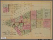
Map of Camp Chase. Drawn on a…
Saratoga Springs [Township]
Schuylerville Business Direct…
Saratoga [Township]
Stillwater [Township]
References; Waterford [Villag…
Waterford [Township]
Beechers Hollow [Village]; Be…
Wilton [Township]
Map of Saratoga County
Residence of James Carrigan, …
Ballston [Township]
Ballston Spa Business Directo…
Charlton [Township]
Grangerville [Village]; Grang…
Clifton Park [Township]
Corinth [Township]; Palmer Fa…
Clifton Park [Village]; Clift…
Day Corners Business Director…
Edinburgh [Township]
Crescent [Village]; Crescent …
Galway [Township]; Yorks Corn…
Greenfield [Township]; Pages …
Bloodville [Village]; Bloodvi…
Hadley [Township]; Hadley Bus…
Half Moon [Township]
Factory Village [Village]; Fa…
Malta [Township]
Burnt Hills [Village]; Burnt …
Milton [Township]
Moreau [Township]
Conklingville [Village]; Conk…
Northumberland [Township]
Providence [Township]; Hagedo…
References; Saratoga Springs …
New-York and vicinity as prop…
Map of the County of New York…
m
Sanitary & topographical map …
Map of the rail-roads of the …
Region of Bone-Boiling and Sw…
Johnson's Georgetown and the …
Portion of the Military depar…
Map of the water region: adja…
Map showing route of marches …
Map of the territory of Minne…
Johnson's Minnesota
Map shewing the position of t…
Map of Lafayette Co.: [Wiscon…
Blanchard's map of Wisconsin …
Johnson's Nebraska, Dakota, I…
1
2
Previous
Next
1
2
Previous
Next