Click to visit the main New York Public Library Homepage
The New York Public Library
Digital Collections
About Digital Collections
Browse
Search only public domain materials
Items
Collections
Divisions
Home
Search
Browse
About
Search only public domain materials
Items
Collections
Divisions
Digital Collections
Using Images
Using Data
Search
Filtered search
Show filters
Hide filters
Show Only Public Domain
topic
Administrative and political divisions
84
Railroads
66
Landowners
49
Real property
44
City planning
19
More
Less
name
Dripps, M. (Matthew)
19
G.W. & C.B. Colton & Co
15
American Photo-Lithographic Company
10
Weed, Parsons & Co
9
Colton, G. Woolworth (George Woolworth), 1827-1901
8
More
Less
collection
x
Maps of New York City and State
place
New York (State)
214
New York (N.Y.)
85
Manhattan (New York, N.Y.)
66
New York
58
Brooklyn (New York, N.Y.)
50
More
Less
genre
Maps
259
Cadastral maps
33
Manuscript maps
17
Topographic maps
4
Surveys
3
More
Less
publisher
publisher not identified
22
M. Dripps
13
G.W. & C.B. Colton & Co
12
J.B. Beers & Co
8
Adirondack survey
5
More
Less
division
Map Division
258
Manuscripts and Archives Division
1
type
x
cartographic
text
4
Date Range
to
259 results found
Filtering on:
x
Date
: 1865 - 1876
x
Collection
: Maps of New York City and State
x
Type
: cartographic
For more collection details, visit the
Maps of New York City and State collection page
.
Sort by:
Title
Date created
Date digitized
Sequence
m
The surroundings of New York …
Map of the country thirty thr…
Map showing location of lands…
Map of the country thirty thr…
Map of the country thirty thr…
Map of New York and vicinity …
Map of the country thirty thr…
New-York and vicinity as prop…
Map of the County of New York…
m
Sanitary & topographical map …
Design for laying out the gro…
m
Map of the city of Brooklyn
Map of the county of Kings, s…
Watson's new map of the city …
New York and environs : desig…
m
Bridgman's map of the suburbs…
Colton's New York City, Brook…
New York and environs : desig…
m
Map of the City of New York a…
m
Watson's new map of New York,…
m
Map of Long Island and the so…
Map of the state of New York:…
Map of the rail roads of the …
Map of the rail-roads of the …
Map of the rail roads of the …
Map shewing the location of t…
m
Colton's new map of Long Isla…
Map of the town of Eastcheste…
Colton's railroad & township …
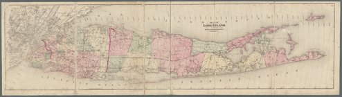
Map of Long Island
Map of Long Island: showing t…
Adirondack survey, 1873: prim…
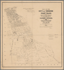
Map of the city of Yonkers, F…
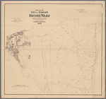
Map of the city of Yonkers, S…
Southern part of Yonkers, and…
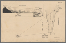
Northern coast of Long Island…
Plan of cemetery of the Everg…
Map of the flats above Albany
New York to New Rochelle: fro…
m
Asher & Adams' new topographi…
Map of pr[op]erty of Union Av…
The Meadows: to be offered at…
Niagara Falls: from surveys e…
Portions of 2nd, 3rd, and 4th…
Map showing location of lands…
Map showing location of lands…
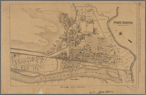
Port Jervis
Map showing location of lands…
Map of land belonging to Feli…
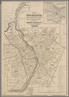
Map of Rochester: from the la…
1
2
Previous
Next
1
2
Previous
Next