Click to visit the main New York Public Library Homepage
The New York Public Library
Digital Collections
About Digital Collections
Browse
Search only public domain materials
Items
Collections
Divisions
Home
Search
Browse
About
Search only public domain materials
Items
Collections
Divisions
Digital Collections
Using Images
Using Data
Search
Filtered search
Show filters
Hide filters
Show Only Public Domain
topic
Real property
419
Business enterprises
181
Administrative and political divisions
112
Railroads
88
Landowners
67
More
Less
name
Beers, F. W. (Frederick W.)
171
Stone & Stewart
129
Beers, D. G. (Daniel G.)
88
Beers, S. N
86
Asher & Adams
63
More
Less
collection
Atlases of the United States
569
Maps of North America
263
Maps of New York City and State
157
Atlases of New York City
142
Pamiatniki stariny v zapadnykh guberniakh imperii
9
More
Less
place
New York (State)
512
Westchester County (N.Y.)
98
Brooklyn (New York, N.Y.)
65
New York Metropolitan Area
60
New York (N.Y.)
59
More
Less
genre
Maps
1143
Atlases
539
Cadastral maps
56
Prints
37
Manuscript maps
18
More
Less
publisher
Stone & Stewart
86
publisher not identified
51
F. W. Beers, A. D. Ellis & others
48
Beers, Ellis & Soule
46
C. K. Stone
40
More
Less
division
Map Division
1132
Rare Book Division
14
General Research Division
13
Schomburg Jean Blackwell Hutson Research and Reference Division
6
Milstein Division
1
type
x
cartographic
text
18
still image
13
Date Range
to
1,166 results found
Filtering on:
x
Date
: 1866 - 1872
x
Type
: cartographic
Sort by:
Title
Date created
Date digitized
Sequence
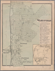
Map Showing the Telegraph Lin…
Plan chasti goroda Vladimira …
Plan chasti goroda Lutska s p…
Plan chasti goroda Ostroga s …
Plan chasti goroda Ovrucha s …
Plan chasti goroda Vil’ny s p…
Plan goroda Vil’ny pervoi pol…
Mappa tsarstv Galitskago I Vl…
Plan goroda Liublina.
Gorod Kholm v XVII v. S gravi…
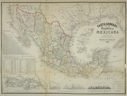
Carta general de la Republica…
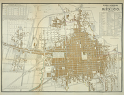
Plano general de la ciudad de…
Assyrie. Archéologique et mod…
m
Supreme COurt Partition Sale.…
m
320 Splendid Lots. Williamson…
m
To close a partnership these …
Upper Nubia and Abyssinia
Map of part of Central Africa…
A map showing the routes of s…
Map showing the distribution …
Countries in the northern tro…
Map of the United States and …
Map of the states of Californ…
Colton's new sectional map of…
Railroad map of the United St…
Birds eye view of the city of…
From St. Christopher to Eusta…
Novi Belgii: Tabula ad N. J. …
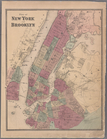
Plate 5: Map of New York and …
Plate 6: Plan of New York and…
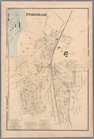
Plate 9: Tremont : Town of We…
Plate 11: Fordham
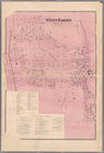
Plate 13: West Farms, Westche…
Plate 15: Wakefield : Town & …
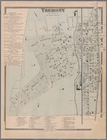
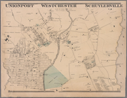
Plate 16: Unionport - Westche…
Plate 17: Map of the Woodlawn…
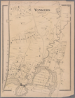
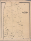
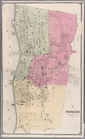
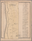
Plate 19: Town of Yonkers, We…
Plate 20: Yonkers, Westcheste…
Plate 21: Town of Yonkers, We…
Plate 23: Yonkers, Westcheste…
Plate 24: Northern part of To…
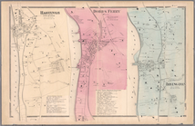
Plate 26: Hastings upon Hudso…
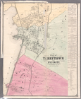
Plate 28: Plan of Tarrytown a…
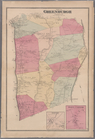
Plate 30: Town of Greenburgh,…
Plate 32: Town of East Cheste…
Plate 34: Mount Vernon, Westc…
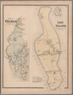
Plate 35: City Island, Pelham…
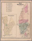
Plate 36: Town of New Rochell…
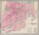
Plate 38: New Rochelle, Westc…
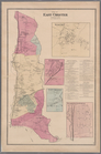
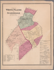
Plate 39: Towns of White Plai…
1
2
3
4
5
Previous
Next
1
2
3
4
5
Previous
Next