Click to visit the main New York Public Library Homepage
The New York Public Library
Digital Collections
About Digital Collections
Browse
Search only public domain materials
Items
Collections
Divisions
Home
Search
Browse
About
Search only public domain materials
Items
Collections
Divisions
Digital Collections
Using Images
Using Data
Search
Filtered search
Show filters
Hide filters
Show Only Public Domain
topic
Real property
419
Business enterprises
181
Administrative and political divisions
112
Railroads
88
Landowners
67
More
Less
name
Beers, F. W. (Frederick W.)
171
Stone & Stewart
129
Beers, D. G. (Daniel G.)
88
Beers, S. N
86
Asher & Adams
63
More
Less
collection
Atlases of the United States
569
Maps of North America
263
Maps of New York City and State
157
Atlases of New York City
142
Pamiatniki stariny v zapadnykh guberniakh imperii
9
More
Less
place
New York (State)
512
Westchester County (N.Y.)
98
Brooklyn (New York, N.Y.)
65
New York Metropolitan Area
60
New York (N.Y.)
59
More
Less
genre
Maps
1143
Atlases
539
Cadastral maps
56
Prints
37
Manuscript maps
18
More
Less
publisher
Stone & Stewart
86
publisher not identified
51
F. W. Beers, A. D. Ellis & others
48
Beers, Ellis & Soule
46
C. K. Stone
40
More
Less
division
Map Division
1132
Rare Book Division
14
General Research Division
13
Schomburg Jean Blackwell Hutson Research and Reference Division
6
Milstein Division
1
type
x
cartographic
text
18
still image
13
Date Range
to
1,166 results found
Filtering on:
x
Date
: 1866 - 1872
x
Type
: cartographic
Sort by:
Title
Date created
Date digitized
Sequence
m
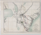
12,000 Square Miles around Ne…
m
320 Splendid Lots. Williamson…
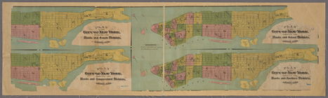
4 plans of the City of New Yo…
m
40 miles around New York. H. …
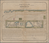
64 Central Park Lots, New Yor…
A diagram of the state of Ala…
A map of the county between C…
A map showing the routes of s…
m
A new map of Indiana : exhibi…
A new map of the states of Ca…
m
A new township map of the sta…
A plan of the town of Pittsfo…
A Tracing of parts of the sta…
Abbotts Corners [Village]; Ab…
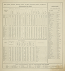
Acres of Land, Population, Dw…
Action of Aroge
Akron [Village]; Akron Busine…
Alaska and adjoining region
Alaska and adjoining territor…
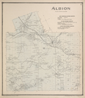
Albion [Township]; New Center…
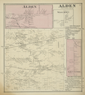
Alden [Village]; Alden [Towns…
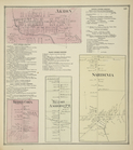
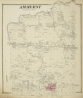
Amherst [Township]
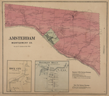
Amsterdam Montgomery Co. [Tow…
m
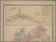
Andes [Village]; Union Grove …
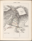
Antietam
Appendix
Appomattox Court House : from…
Argusville Business Directory…
Asher & Adams' new map of the…
Asher & Adams' New Topographi…
m
Asher & Adams' new topographi…
Ashville [Village]; Ashville …
Assyrie. Archéologique et mod…
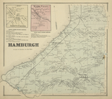
Atlas of Clinton Co., New Yor…
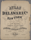
Atlas of Delaware Co., New Yo…
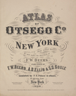
Atlas of Otsego Co., New York.
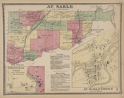
Au Sable [Township]; Birmingh…
m
Auction sale at Montrose Stat…
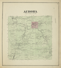
Aurora [Township]
Aurora Woolen Mills, Torry & …
Azoic and paleozoic formation…
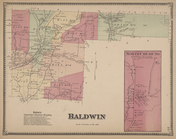
Baldwin Subscriber's Business…
Balloon view of Narragansett …
Ballston [Township]
Ballston Spa Business Directo…
Battle of the Thames
Beechers Hollow [Village]; Be…
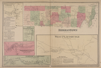
Beekmantown Corners [Village]…
Benham's new map of the city …
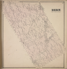
Bern [Township]
1
2
3
4
5
Previous
Next
1
2
3
4
5
Previous
Next