Click to visit the main New York Public Library Homepage
The New York Public Library
Digital Collections
About Digital Collections
Browse
Search only public domain materials
Items
Collections
Divisions
Home
Search
Browse
About
Search only public domain materials
Items
Collections
Divisions
Digital Collections
Using Images
Using Data
Search
Filtered search
Show filters
Hide filters
Show Only Public Domain
topic
Real property
11
Administrative and political divisions
9
Landowners
9
Railroads
5
History
4
More
Less
name
Ewer, Ferdinand C. (Ferdinand Cartwright), 1826-1883
2
Bloomfield, J. J
1
Chauncey Real Estate Co
1
Clay, Cosack & Co
1
Davis, Thomas W. (Surveyor)
1
More
Less
collection
Maps of North America
27
Maps of New York City and State
12
place
New York (State)
9
Brooklyn (New York, N.Y.)
8
Massachusetts
5
New York
5
Kings County (N.Y.)
4
More
Less
genre
Maps
39
Cadastral maps
11
Illustrations
1
Outline maps
1
Portraits
1
More
Less
publisher
x
publisher not identified
D. McLellan, lithographer
1
division
Map Division
39
type
x
cartographic
still image
2
text
1
Date Range
to
39 results found
Filtering on:
x
Date
: 1869 - 1871
x
Publisher
: publisher not identified
x
Type
: cartographic
Sort by:
Title
Date created
Date digitized
Sequence
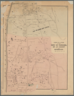
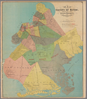
Map of the county of Kings, s…
Map of the rail roads of the …
Plan of the French and Americ…
Map of central Keweenaw Penin…
Mineral company lands : shade…
Eagle Harbor Copper Co, and E…
Map of the city of Erie : sho…
Hyde Park : [Chicago, Illinoi…
Half of an unidentified map s…
Fragment of a map, covering p…
Historical map of Nantucket
Vernon Co., Mo. : plat of tow…
Plan of Louisville, Ky. and t…
Plat of the town of Elmhurst,…
Nashua River
Octagonal map of the environs…
Map of the Pittsburg & Baltim…
County and railroad map of th…
Map of the city of Newport an…
Enlarged map of the coast fro…
Map of the territory of the […
Mail and passenger route from…
Map of Black Point property n…
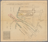
Plan of Suffolk Street Distri…
Map of Dobbs Ferry and Hastin…
Historical map of Nantucket
Map of Silver Lake on the Ply…
Parts of 1st ward of the city…
Hartford in 1640
m
Outline map showing a new rou…
Map of Highbridgeville in the…
Railroad map of New England
m
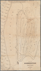
Brooklyn City Hall
m
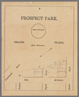
Prospect Park, plaza lots
m
Map showing the injury to the…
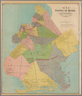
Map of the county of Kings, s…
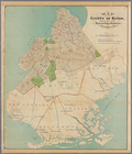
Map of the county of Kings, s…
Map of the county of Kings, s…
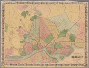
Map of the city of Brooklyn, …
End of results
|
Top