Click to visit the main New York Public Library Homepage
The New York Public Library
Digital Collections
About Digital Collections
Browse
Search only public domain materials
Items
Collections
Divisions
Home
Search
Browse
About
Search only public domain materials
Items
Collections
Divisions
Digital Collections
Using Images
Using Data
Search
Filtered search
Show filters
Hide filters
Show Only Public Domain
topic
Administrative and political divisions
58
Real property
56
Railroads
46
Landowners
30
Business enterprises
22
More
Less
name
Beers, F. W. (Frederick W.)
75
Asher & Adams
63
Sanford, G. P. (George P.)
22
Barton, William (fl. 1869)
13
Dripps, M. (Matthew)
11
More
Less
collection
Atlases of the United States
148
Maps of North America
133
Maps of New York City and State
89
Atlases of New York City
8
The pictorial field-book of the War of 1812; or, Illustrations, by pen and pencil, of the history, biography, scenery, relics, and traditions of the last war for American independence
5
More
Less
place
New York (State)
156
New York (N.Y.)
37
Manhattan (New York, N.Y.)
32
Delaware County (N.Y.)
30
Brooklyn (New York, N.Y.)
28
More
Less
genre
Maps
387
Atlases
148
Cadastral maps
28
Manuscript maps
12
Prints
9
More
Less
publisher
Beers, Ellis & Soule
45
publisher not identified
39
Published by F. W. Beers, A. D. Ellis & G. G. Soule
30
M. Dripps
10
Harper & Brothers
7
More
Less
division
Map Division
378
General Research Division
6
Rare Book Division
5
Schomburg Jean Blackwell Hutson Research and Reference Division
3
type
x
cartographic
still image
5
text
2
Date Range
to
392 results found
Filtering on:
x
Date
: 1869 - 1871
x
Type
: cartographic
Sort by:
Title
Date created
Date digitized
Sequence
Map drawn for "The Morningsid…
Map of the city of St. Louis …
Map of Black Point property n…
Map of Chicago : showing the …
Map of Woburn: published with…
m
Hardee's geographical, histor…
Map of the state of Missouri
Franklin County
m
Auction sale at Montrose Stat…
Map of the diocese of Massach…
Sectional land map of the Bur…
Lloyd's topographical map of …
Colton's new map of the state…
Map of the city of Albany
Map of southern New Hampshire
Map of the state of Missouri …
m
Map of the city and suburbs o…
Map of the Pittsburg & Baltim…
m
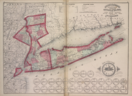
Map of Long Island and the so…
Map of the boundaries of the …
Map accompanying the report o…
Map of the city of New York m…
Grade map, Palace of Industry…
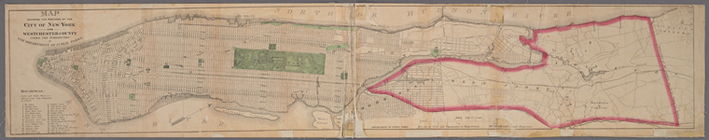
Map showing the portions of t…
Map of West Street from Batte…
Colton's new topographical ma…
Asher & Adams' New Topographi…
Index
Railroads of the state.
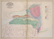
Geological Map
Meteorological Map
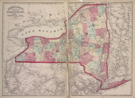
New York City
United States And Territories…
Europe
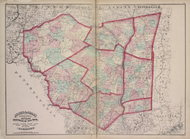
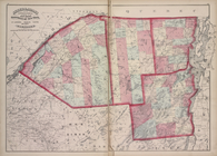
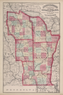
Putman, Rockland, Westchester…
Delaware, Sullivan, Greene, U…
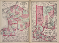
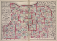
Oneida, Madison, Otsego, Fult…
Jefferson, Oswego, and Lewis …
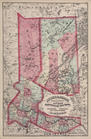
Herkimer, Hamilton, and Montg…
St. Lawrence, Franklin, Clint…
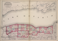
Monroe, Livingston, Allegany,…
Niagara, Orleans, Genesee, Mo…
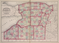
Niagara, Erie, Chautauqua, Ca…
Onondaga, Cortland, Broome, M…
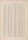
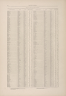
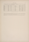
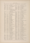
Gazetteer of New York [60]
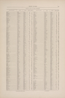
Gazetteer of New York [61]
Gazetteer of New York [62]
Gazetteer of New York [63]
Gazetteer of New York [64]
Gazetteer of New York [65]
1
2
Previous
Next
1
2
Previous
Next