Click to visit the main New York Public Library Homepage
The New York Public Library
Digital Collections
About Digital Collections
Browse
Search only public domain materials
Items
Collections
Divisions
Home
Search
Browse
About
Search only public domain materials
Items
Collections
Divisions
Digital Collections
Using Images
Using Data
Search
Filtered search
Show filters
Hide filters
Show Only Public Domain
topic
Administrative and political divisions
58
Real property
56
Railroads
46
Landowners
30
Business enterprises
22
More
Less
name
Beers, F. W. (Frederick W.)
75
Asher & Adams
63
Sanford, G. P. (George P.)
22
Barton, William (fl. 1869)
13
Dripps, M. (Matthew)
11
More
Less
collection
Atlases of the United States
148
Maps of North America
133
Maps of New York City and State
89
Atlases of New York City
8
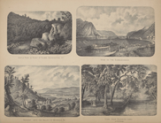
The pictorial field-book of the War of 1812; or, Illustrations, by pen and pencil, of the history, biography, scenery, relics, and traditions of the last war for American independence
5
More
Less
place
New York (State)
156
New York (N.Y.)
37
Manhattan (New York, N.Y.)
32
Delaware County (N.Y.)
30
Brooklyn (New York, N.Y.)
28
More
Less
genre
Maps
387
Atlases
148
Cadastral maps
28
Manuscript maps
12
Prints
9
More
Less
publisher
Beers, Ellis & Soule
45
publisher not identified
39
Published by F. W. Beers, A. D. Ellis & G. G. Soule
30
M. Dripps
10
Harper & Brothers
7
More
Less
division
Map Division
378
General Research Division
6
Rare Book Division
5
Schomburg Jean Blackwell Hutson Research and Reference Division
3
type
x
cartographic
still image
5
text
2
Date Range
to
392 results found
Filtering on:
x
Date
: 1869 - 1871
x
Type
: cartographic
Sort by:
Title
Date created
Date digitized
Sequence
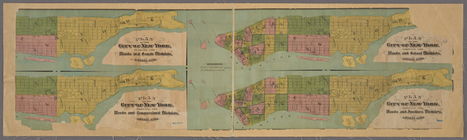
4 plans of the City of New Yo…
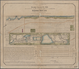
64 Central Park Lots, New Yor…
A map showing the routes of s…
m
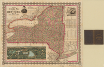
A new township map of the sta…
A Tracing of parts of the sta…
Action of Aroge
Alaska and adjoining territor…
m
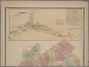
Andes [Village]; Union Grove …
Appendix
Asher & Adams' new map of the…
Asher & Adams' New Topographi…
m
Asher & Adams' new topographi…
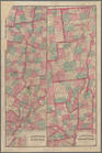
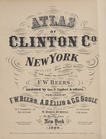
Atlas of Clinton Co., New Yor…
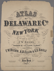
Atlas of Delaware Co., New Yo…
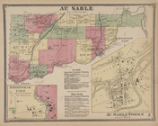
Au Sable [Township]; Birmingh…
m
Auction sale at Montrose Stat…
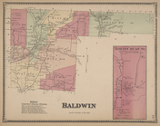
Baldwin Subscriber's Business…
Balloon view of Narragansett …
Battle of the Thames
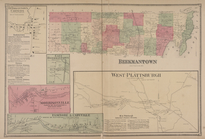
Beekmantown Corners [Village]…
Benham's new map of the city …
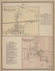
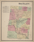
Big Flats [Village]; Big Flat…
Big Flats Subscriber's Busine…
Bird's eye view of the city o…
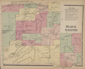
Black Brook [Township]; Black…
m
Blanchard's map of Cook and D…
Block bounded by 2nd Ave., 99…
m
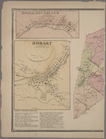
Bovina or Brushland [Village]…
m
Brooklyn City Hall
m
Cabinet map of Iowa
Castle Rock or Point of Rocks…
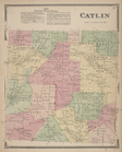
Catlin Business Directory; Ca…
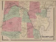
Champlain [Township]
Charleston harbor : showing t…
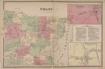
Chazy [Township]; Sciota [Vil…
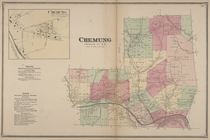
Chemung [Village]; Chemung Su…
City and harbor of Portland, …
City of Chicago
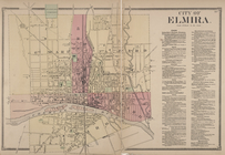
City of Elmira.; Elmira Subsc…
m
City of Houston, Harris Co., …
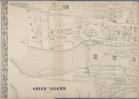
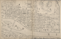
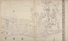
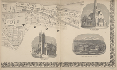
City of Troy
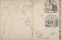
City of Troy [cont.]
City of Troy [cont.]
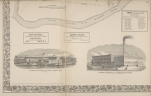
City of Troy [cont.]; St. Pau…
City of Troy [cont.]; St. Pet…
City of Troy [cont.]; Starbuc…
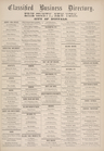
Classified Business Directory…
Classified Business Directory…
Classified Business Directory…
Classified Business Directory…
1
2
Previous
Next
1
2
Previous
Next