Click to visit the main New York Public Library Homepage
The New York Public Library
Digital Collections
About Digital Collections
Browse
Search only public domain materials
Items
Collections
Divisions
Home
Search
Browse
About
Search only public domain materials
Items
Collections
Divisions
Digital Collections
Using Images
Using Data
Search
Filtered search
Show filters
Hide filters
Show Only Public Domain
topic
Administrative and political divisions
21
Railroads
19
Landowners
17
Real property
16
Buildings
7
More
Less
name
Bourquin, F. (Frederick), 1808-
4
Worley & Bracher
4
G.W. & C.B. Colton & Co
3
New York Lithographing, Engraving and Printing Co
3
United States Coast Survey
3
More
Less
collection
Maps of North America
59
Maps of New York City and State
40
A map showing the routes of some native caravans from the coast to the interior of Eastern Africa, from information collected by the Rev. T. Wakefield ... also of two personal journeys to the Southern Galla country made by the Rev. Wakefield & C. New in 1865 and 1866-7
1
Map showing the distribution of slaves in the Southern States
1
Record of the expedition to Abyssinia
1
More
Less
place
New York (State)
35
New York (N.Y.)
20
Manhattan (New York, N.Y.)
19
Brooklyn (New York, N.Y.)
8
New Jersey
7
More
Less
genre
Maps
102
Cadastral maps
15
Manuscript maps
9
Nautical charts
3
Military maps
2
More
Less
publisher
publisher not identified
23
A. von Steinwehr
2
F.H. McDowell
2
Fairmount Park Commission?
2
J.R. Osgood
2
More
Less
division
Map Division
99
Schomburg Jean Blackwell Hutson Research and Reference Division
3
General Research Division
1
type
x
cartographic
text
2
still image
1
Date Range
to
103 results found
Filtering on:
x
Date
: 1870 - 1870
x
Type
: cartographic
Sort by:
Title
Date created
Date digitized
Sequence
Map shewing the location of t…
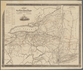
Map of the rail roads of the …
Map of the New York state can…
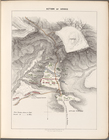
Action of Aroge
Asher & Adams' new map of the…
Map of Dobbs Ferry and Hastin…
Northern coast of Long Island…
Verein-Staaten von Nord-Ameri…
Map of the United States and …
Enlarged map of the coast fro…
m
Outline map showing a new rou…
Map of Providence and Worcest…
Map of Providence and Worcest…
Map showing the New York and …
Map showing the connections o…
m
Post route map of the states …
Benham's new map of the city …
Hartford in 1640
Johnson's Kansas and Nebraska
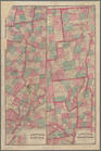
County and railroad map of th…
Map of New Orleans and Jeffer…
Map of Talbot County Maryland
Map of Silver Lake on the Ply…
Map of the city of Worcester:…
The harbor of New Bedford
Nashua River
Plan of Boston and its vicini…
Map of Boston and vicinity: e…
Colton's Guide map of Michigan
Map of a part of the Village …
Eagle Harbor Copper Co, and E…
Map showing lands of St. Mary…
Map of central Keweenaw Penin…
Mineral company lands : shade…
Magneto-geological chart of R…
Rice & Reed's township map of…
McClung's map of Minnesota : …
Vernon Co., Mo. : plat of tow…
Map of St. Louis and environs…
m
Colton's new sectional map of…
Fragment of a map, covering p…
Map showing detailed topograp…
The lake country of New Hamps…
The lake country of New Hamps…
Topographical map of that por…
Map of property of the Ruther…
Llewellyn Park, West Orange, …
Map showing lines filed by Ne…
Outline map of the rail roads…
Fac simile of Holmes' map of …