Click to visit the main New York Public Library Homepage
The New York Public Library
Digital Collections
About Digital Collections
Browse
Search only public domain materials
Items
Collections
Divisions
Home
Search
Browse
About
Search only public domain materials
Items
Collections
Divisions
Digital Collections
Using Images
Using Data
Search
Filtered search
Show filters
Hide filters
Show Only Public Domain
topic
Real property
987
Administrative and political divisions
214
Business enterprises
181
Railroads
174
Description and travel
142
More
Less
name
Beers, F. W. (Frederick W.)
311
Everts, Ensign & Everts
231
G.M. Hopkins & Co
161
D.G. Beers & Co
149
F.W. Beers & Co
148
More
Less
collection
Atlases of the United States
1199
Maps of North America
534
Atlases of New York City
339
Maps of New York City and State
257
Atlases, gazetteers, guidebooks and other books
26
More
Less
place
New York (State)
1185
New York
229
Brooklyn (New York, N.Y.)
194
Erie County
148
Erie County (N.Y.)
148
More
Less
genre
x
Maps
Atlases
1167
Cadastral maps
103
Topographic maps
28
Geological maps
27
More
Less
publisher
F. W. Beers & Co
148
G.M. Hopkins & Co
101
Everts, Ensign & Everts
99
Beers, Comstock & Cline
98
publisher not identified
80
More
Less
division
Map Division
2362
Wallach Division: Photography Collection
9
General Research Division
7
Schomburg Jean Blackwell Hutson Research and Reference Division
7
Wallach Division: Picture Collection
5
More
Less
type
cartographic
2390
still image
33
text
25
Date Range
to
2,398 results found
Filtering on:
x
Date
: 1870 - 1880
x
Genre
: Maps
Sort by:
Title
Date created
Date digitized
Sequence
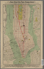
Map of the City of New York :…
Map of New York City
Map showing route of the New …
m
Map of the City of New York n…
Map showing the Adirondack La…
Bayfield & Ashland Counties i…
Birds-eye view of the White M…
m
Map of McLeod County, Minneso…
Progress map of the state of …
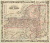
Map of Massachusetts
Rand, McNally & Co.'s Minneso…
Map of Boston and vicinity
Rand, McNally & Co.'s new geo…
Map of the Shenandoah Valley …
m
Map of Meeker County, Minneso…
m
Preliminary post route map of…
Plan of the village of Marque…
m
Preliminary post route map of…
m
Colton's new map of the city …
Map showing the only all rail…
m
Hotchkiss' geological map of …
m
Post route map of the states …
Mount Desert [Island] via Bos…
Map of part of the Manor of P…
Map of the north western part…
Plan showing encroachments up…
Sketch map of Pascataway, Mai…
m
Post route map of the state o…
Plan of the town Ebenezer and…
The Caron map of the city of …
Route of the Albany & New Yor…
m
Map of Scott County, Minnesot…
New map of New York City: fro…
Map showing horse rail roads …
Colton's railroad & township …
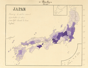
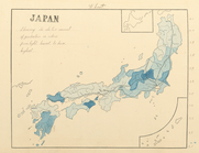
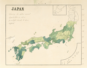
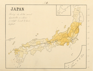
Japan, barley, showing the re…
Japan, wheat, showing the rel…
Japan, tea, showing the relat…
Japan, silk, showing the rela…
Braunau und Triftern.
Klausen. …
Outline & Index Map of Brookl…
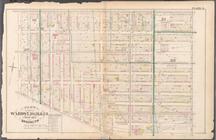
Plate 1:Bounded by Furman Str…
Plate 2: Bounded by Adams Str…
Plate 3: Bounded by Pierpont …
Plate 4: Bounded by Smith Str…
Plate 5: Bounded by Baltic St…
Plate 6: Bounded by Clinton A…
Plate 7: Bounded by Flushing …
Plate 8: Bounded by De Kalb A…
1
2
3
4
5
6
7
8
9
10
Previous
Next
1
2
3
4
5
6
7
8
9
10
Previous
Next