Click to visit the main New York Public Library Homepage
The New York Public Library
Digital Collections
About Digital Collections
Browse
Search only public domain materials
Items
Collections
Divisions
Home
Search
Browse
About
Search only public domain materials
Items
Collections
Divisions
Digital Collections
Using Images
Using Data
Search
Filtered search
Show filters
Hide filters
Show Only Public Domain
topic
Real property
205
Description and travel
142
Business enterprises
87
Administrative and political divisions
49
Railroads
38
More
Less
name
Beers, F. W. (Frederick W.)
173
Beers, Comstock & Cline
97
D.G. Beers & Co
87
Asher & Adams
61
J.B. Beers & Co
51
More
Less
collection
Atlases of the United States
339
Maps of North America
116
Atlases of New York City
111
Maps of New York City and State
64
Sobranīe kart, planov i risunkov k trudam pervago arkheologicheskago s︠i︡ezda
4
More
Less
place
New York (State)
248
Long Island (N.Y.)
97
New Jersey
87
Westchester County (N.Y.)
67
Steuben County (N.Y.)
52
More
Less
genre
Maps
639
Atlases
309
Cadastral maps
23
Manuscript maps
6
Prints
6
More
Less
publisher
Beers, Comstock & Cline
97
D.G. Beers
52
D. G. Beers & Co
35
G.M. Hopkins
30
Spielmann & Brush,
29
More
Less
division
Map Division
630
General Research Division
5
Schomburg Jean Blackwell Hutson Research and Reference Division
4
Milstein Division
1
type
x
cartographic
text
7
still image
3
Date Range
to
640 results found
Filtering on:
x
Date
: 1871 - 1873
x
Type
: cartographic
Sort by:
Title
Date created
Date digitized
Sequence
Map showing location of lands…
m
Map of the city of Brooklyn
m
Bridgman's map of the suburbs…
Colton's New York City, Brook…
m
Watson's new map of New York,…
m
Topographical map of central …
m
Map of Long Island and the so…
Map of the rail roads of the …
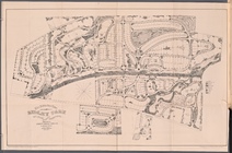
The Suburban Town of Ridley P…
Plan of land on West Chester …
New and enlarged map of Balti…
Map of Chicago and its wester…
Map of Chicago : showing the …
Bird's eye view of Philadelph…
Map of part of Marquette Coun…
m
Map of the city of St. Louis,…
Township no. 20 North, Range …
Rice's township & rail road m…
Map of Philadelphia photograp…
Map of the Iron Cliffs Co.'s …
Preliminary geological map of…
Map of the state of Missouri …
Map showing lands of the Iron…
Map showing iron mines in vic…
New and improved map of the c…
Map of the iron mines of Lake…
Map of Dearborn, Ohio, and Sw…
Map of Pike and Dubois Counti…
Blanchard's Guide map of Kans…
Map of the city of Erie : sho…
Map of roads from Fort Dodge,…
Portion of the copper distric…
Preliminary map to a geologic…
Guide map of the best and sho…
Map showing the route of the …
Preliminary map of Central Co…
Thayer's map of Colorado
Thayer's map of Colorado
Preliminary map of the survey…
The North End Mines : field …
Topographical map showing the…
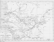
North western America : showi…
Carte du Soudan Occidental dr…
m
Map of the city and suburbs o…
Map of the sources of Snake R…
County map of the state of Ca…
Map of the San Joaquin, Sacra…
Map of Northern Arizona
The Yukon River, Alaska : fro…
Lincoln, the capital of Nebra…
1
2
3
Previous
Next
1
2
3
Previous
Next