Click to visit the main New York Public Library Homepage
The New York Public Library
Digital Collections
About Digital Collections
Browse
Search only public domain materials
Items
Collections
Divisions
Home
Search
Browse
About
Search only public domain materials
Items
Collections
Divisions
Digital Collections
Using Images
Using Data
Search
Filtered search
Show filters
Hide filters
Show Only Public Domain
topic
Real property
540
Business enterprises
180
Description and travel
141
Administrative and political divisions
103
Railroads
82
More
Less
name
Beers, F. W. (Frederick W.)
311
Everts, Ensign & Everts
231
D.G. Beers & Co
149
Beers, Comstock & Cline
97
J.B. Beers & Co
87
More
Less
collection
Atlases of the United States
888
Maps of North America
253
Atlases of New York City
160
Maps of New York City and State
119
Wallach Division Picture Collection
4
More
Less
place
New York (State)
611
Genesee County (N.Y.)
132
Long Island (N.Y.)
102
Broome County (N.Y.)
99
New Jersey
93
More
Less
genre
x
Maps
Atlases
887
Cadastral maps
44
Geological maps
19
Topographic maps
15
More
Less
publisher
Everts, Ensign & Everts
99
Beers, Comstock & Cline
97
Reading Publishing House
71
D.G. Beers
52
Pomeroy
42
More
Less
division
Map Division
1425
Wallach Division: Picture Collection
4
Manuscripts and Archives Division
2
Wallach Division: Art & Architecture Collection
2
Wallach Division: Photography Collection
2
More
Less
type
cartographic
1434
text
18
still image
15
Date Range
to
1,439 results found
Filtering on:
x
Date
: 1873 - 1878
x
Genre
: Maps
Sort by:
Title
Date created
Date digitized
Sequence
Map of Great Fire, 1776
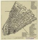
Map of New York, Brooklyn, an…
m
The surroundings of New York …
Map of the country thirty thr…
Map showing location of lands…
Map of New York City, south o…
New map of Brooklyn and vicin…
Colton's New York City, Brook…
Ethnological Chart of the Wor…
m
Topographical map of central …
Plan of the city of Philadelp…
Map of Conanicut Island, oppo…
Water shed of the Passaic Riv…
Back Bay and Parker Hill park…
Plan of burnt district (by fi…
Plan of real estate at Harris…
Plan showing the redoubt, bre…
Map of Boston for 1878: Publi…
Plan of land on West Chester …
Map of Boston and the country…
Map--S'emka Bolgarii mezhdu R…
S'emka Bolgarii mezhdu R. R. …
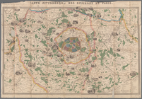
Carte pittoresque des environ…
New and improved map of the c…
Map of a part of the Village …
Plan of the grounds and build…
Our centennial--plan of the g…
Map of Chicago and its wester…
State of Indiana
Hunt's map of Philadelphia : …
A.R. Roessler's latest map of…
m
Revised map of the state of T…
m
Map of Bates County, Missouri
m
Map of Johnson County, Missou…
m
Map of Pettis County, Missour…
m
Map of Goodhue County, Minnes…
Railroad map of Michigan
Geological map of the Lower P…
m
Post route map of the states …
m
Map of Christian County, Ky. …
Plan of the Brunswick lots in…
Plan of the city of New Orlea…
Plan of the grounds and build…
Railroads of Minneapolis and …
Map of the compact portion of…
Map of Rochester, Olmsted Co.…
State of Michigan
Map of the centennial grounds…
Reference map of a portion of…
m
The Centennial--balloon view …
1
2
3
4
5
6
Previous
Next
1
2
3
4
5
6
Previous
Next