Click to visit the main New York Public Library Homepage
The New York Public Library
Digital Collections
About Digital Collections
Browse
Search only public domain materials
Items
Collections
Divisions
Home
Search
Browse
About
Search only public domain materials
Items
Collections
Divisions
Digital Collections
Using Images
Using Data
Search
Filtered search
Show filters
Hide filters
Show Only Public Domain
topic
x
Real property
Landowners
52
Administrative and political divisions
17
Railroads
8
Land grants
5
More
Less
name
Welcke, Robert A
11
Hyde & Company
4
J.B. Beers & Co
3
Yonkers (N.Y.). Common Council
3
Balliet & Volk
2
More
Less
collection
x
Maps of New York City and State
place
New York (State)
113
New York
51
Brooklyn (New York, N.Y.)
17
New York (N.Y.)
14
Queens (New York, N.Y.)
12
More
Less
genre
Maps
114
Cadastral maps
63
Manuscript maps
12
Aerial views
3
Drawings
1
More
Less
publisher
publisher not identified
13
publisher unknown
7
Common Council
3
Hyde & Company
3
J.B. Beers & Co
3
More
Less
division
Map Division
114
type
cartographic
114
Date Range
to
114 results found
Filtering on:
x
Date
: 1874 - 1956
x
Collection
: Maps of New York City and State
x
Topic
: Real property
For more collection details, visit the
Maps of New York City and State collection page
.
Sort by:
Title
Date created
Date digitized
Sequence
m
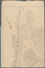
Map of property belonging to …
Map of lots belonging to the …
Map of Brooklyn Manor
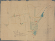
Map of Flatbush Meadows : sit…
Tracts and farms with street …
Rosedale Square, Rosedale : 4…
Map of Jamaica in the 4th war…
Map of property New York Dock…
Map of Kissena Park, third wa…
Block sketch 1679, New York C…
East River Heights, first war…
Map of Bellaire Estates : own…
Hollis Terrace addition no. 1…
Map of 272 lots in the 30th w…
Map of Jamaica Fells : fourth…
m
Map of the borough of Queens,…
Borough Park Company
m
Sea Gate, New York Harbor
Map of Elmhurst Square : situ…
Plan of the great meadows of …
m
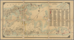
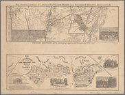
Driving road chart of the cou…
Block no. 86 : confidential r…
Livingston Heights : Livingto…
Map of portion of greater New…
m
Map of Long Island: based upo…
m
Map of Long Island: based upo…
Map of part of the Manor of P…
Map of the town of Eastcheste…
Map of Long Island: showing t…
Map of the head waters of the…
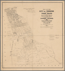
Map of the city of Yonkers, F…
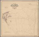
Map of the city of Yonkers, S…
m
Map of the property of the Yo…
Plan of the Country Club Land…
m
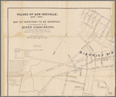
Village of New-Rochelle, New-…
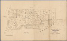
Rochelle Park, New-Rochelle, …
M[ap of par]t of the property…
Map of the village of Lyon Mo…
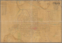
Map of City of Ithaca, N.Y.: …
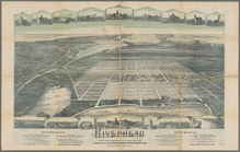
Riverhead, the home resort of…
m
Map of the city of Poughkeeps…
m
Map of choice building sites …
Map showing location of lands…
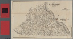
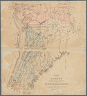
Plan of Orange County, New Yo…
Historical sketch map of King…
m
Castle Ridge, Tarrytown, West…
m
Map of Mount Vernon and envir…
Map of Knollwood, Elmsford, W…
Pencil sketch of Rochester, N…
Map of the manors erected wit…