Click to visit the main New York Public Library Homepage
The New York Public Library
Digital Collections
About Digital Collections
Browse
Search only public domain materials
Items
Collections
Divisions
Home
Search
Browse
About
Search only public domain materials
Items
Collections
Divisions
Digital Collections
Using Images
Using Data
Search
Filtered search
Show filters
Hide filters
Show Only Public Domain
topic
x
Real property
Cities & towns
3086
Fire insurance
3086
Business enterprises
121
History
90
More
Less
name
Sanborn Map Company
3086
Beers, F. W. (Frederick W.)
180
F.W. Beers & Co
148
Everts, Ensign & Everts
132
G.M. Hopkins & Co
108
More
Less
collection
Atlases of New York City
3318
Atlases of the United States
562
Maps of New York City and State
29
place
x
New York (State)
New York
240
Brooklyn (New York, N.Y.)
151
Erie County
148
Erie County (N.Y.)
148
More
Less
genre
Maps
3809
Atlases
562
Prints
49
Cadastral maps
19
Title pages
12
More
Less
publisher
Sanborn Map Company
3086
F. W. Beers & Co
148
G.M. Hopkins & Co
108
Andreas, Baskin & Burr
90
G. W. Bromley & E. Robinson
80
More
Less
division
Map Division
3909
type
cartographic
3857
text
53
still image
1
Date Range
to
3,909 results found
Filtering on:
x
Date
: 1875 - 1885
x
Place
: New York (State)
x
Topic
: Real property
Sort by:
Title
Date created
Date digitized
Sequence
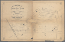
Map of part of the Manor of P…
Map of the town of Eastcheste…
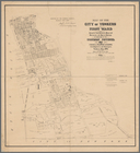
Map of the city of Yonkers, F…
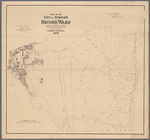
Map of the city of Yonkers, S…
Map of the village of Lyon Mo…
m
Map of the city of Poughkeeps…
m
Map of choice building sites …
Map showing location of lands…
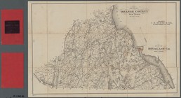
Plan of Orange County, New Yo…
m
Castle Ridge, Tarrytown, West…
m
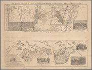
Map of the highlands of the H…
Shonnard Park at Yonkers, est…
m
Huguenot Park, Westchester Co…
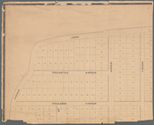
Map of Olean, New York
Map of Webster's Addition to …
Map of the city of Yonkers, T…
Map of Westminster Park of th…
A plott of ye situations of t…
Plan of Sullivan County, New …
Map showing the Adirondack La…
m
Map of the City of New York n…
m
Map of the 23rd ward, New Yor…
Map of land to be acquired un…
Plan of streets etc. on the L…
m
Map of the route of the New Y…
Map of the homestead of the l…
Map of property belonging to …
Map of the Eureka Basin, incl…
Map of property owned by Fran…
Index.
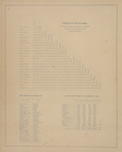
Table of Distances. ; Post Of…
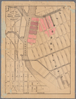
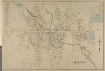
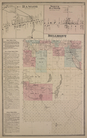
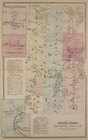
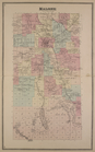
Malone [Village]
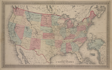
Map of The United States
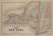
Plan of the states of New Yor…
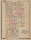
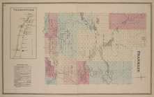
Outline plan of Franklin Co.
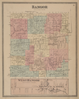
Bangor [Township]; West Bango…
Bangor [Village]; Bagor Busin…
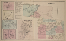
Bombay [Village]; Goodwins Mi…
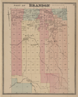
Part of Brandon [Township]
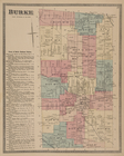
Burke [Township]; Town of Bur…
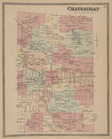
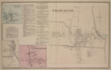
Chateaugay [Township]
Burke [Village]; Burke Busine…
Constable Business Notices. ;…
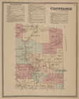
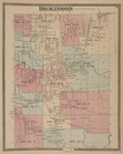
Dickinson [Township]
Dickinson Center [Village]; S…
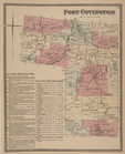
Fort Covington [Township]; Fo…
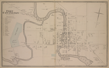
Fort Covington [Village]
Vermontville [Village]; Frank…
Malone [Township]
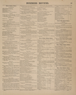
Business Notices.
1
2
3
4
5
6
7
8
9
10
…
15
16
Previous
Next
1
2
3
4
5
6
7
8
9
10
…
15
16
Previous
Next