Click to visit the main New York Public Library Homepage
The New York Public Library
Digital Collections
About Digital Collections
Browse
Search only public domain materials
Items
Collections
Divisions
Home
Search
Browse
About
Search only public domain materials
Items
Collections
Divisions
Digital Collections
Using Images
Using Data
Search
Filtered search
Show filters
Hide filters
Show Only Public Domain
topic
Real property
4301
Fire insurance
3150
Cities & towns
3127
Administrative and political divisions
297
Railroads
269
More
Less
name
Sanborn Map Company
3127
E. Robinson Co
314
Robinson, E. (Elisha)
267
Pidgeon, R. H. (Roger H.)
242
Everts, Ensign & Everts
231
More
Less
collection
Atlases of New York City
3573
Atlases of the United States
1193
Maps of North America
807
Maps of New York City and State
327
Atlases, gazetteers, guidebooks and other books
27
More
Less
place
New York (State)
4436
New York
454
Brooklyn (New York, N.Y.)
260
New York (N.Y.)
244
Erie County
148
More
Less
genre
Maps
5964
Atlases
1190
Cadastral maps
156
Plans
88
Prints
70
More
Less
publisher
Sanborn Map Company
3127
E. Robinson Co
267
F. W. Beers & Co
148
G.M. Hopkins & Co
101
Everts, Ensign & Everts
99
More
Less
division
Map Division
5959
Rare Book Division
17
Manuscripts and Archives Division
15
Schomburg Jean Blackwell Hutson Research and Reference Division
13
Wallach Division: Photography Collection
10
More
Less
type
x
cartographic
still image
49
text
44
Date Range
to
6,029 results found
Filtering on:
x
Date
: 1875 - 1890
x
Type
: cartographic
Sort by:
Title
Date created
Date digitized
Sequence
Results 251 - 300
Post route map of the state o…
Nell's new topographical & to…
Rand, McNally & Co.'s Colorado
Rand, McNally & Co.'s new geo…
Map showing the lines of comm…
General geological map of Col…
m
Post route map of the state o…
Drainage map of Colorado
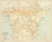
Slave trade map of equatorial…
Territory of Idaho
Map of Utah territory: repres…
Large scale sectional map of …
Map of California : to accomp…
m
Map of Charleston and its vic…
Map of military reservation o…
Judith Basin
m
Map of Judith Basin, Montana …
Map of Crazy Mountains and vi…
Summit Valley Mining District…
County and township map, Mont…
m
Map of Montana: compiled from…
Map of a reconnaissance from …
Montana and Wyoming Territori…
Montana and Wyoming Territori…
Forest map of the Yakima Regi…
Preliminary agricultural map …
m
Preliminary agricultural map …
Map of Yakima Region, Washing…
Map of Yakima Region, Washing…
Map of the city of Tacoma : P…
City of Spokane Falls, Washin…
Spokane Falls : showing in re…
Whitney's map of Seattle and …
Map of the country adjacent t…
Map of Colville Region, Washi…
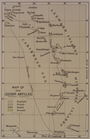
Map of the Lesser Antilles
Outline map of Washoe Distric…
Map of the Lower Comstock and…
Washington Territory
Map of Washington Territory
Map of Washington Territory :…
Washington Territory
Washington Territory
Montana territory
m
Colton's new map of Long Isla…
m
Colton's map of the United St…
A geological and topographica…
Map of Maryland: showing the …
Map of the State of Indiana :…
m
Rand McNally and Co's standar…
1
2
3
4
5
6
7
8
9
10
…
24
25
Previous
Next
1
2
3
4
5
6
7
8
9
10
…
24
25
Previous
Next