Click to visit the main New York Public Library Homepage
The New York Public Library
Digital Collections
About Digital Collections
Browse
Search only public domain materials
Items
Collections
Divisions
Home
Search
Browse
About
Search only public domain materials
Items
Collections
Divisions
Digital Collections
Using Images
Using Data
Search
Filtered search
Show filters
Hide filters
Show Only Public Domain
topic
x
Real property
Landowners
10
Railroads
5
Administrative and political divisions
2
Local transit
2
More
Less
name
G.W. Bromley & Co
457
Ullitz, Hugo
450
E.B. Hyde & Co
383
Bromley, George Washington
377
Bromley, Walter Scott
376
More
Less
collection
Atlases of New York City
1225
Maps of New York City and State
42
Atlases, gazetteers, guidebooks and other books
1
place
x
New York
New York (State)
1268
Brooklyn (New York, N.Y.)
619
Manhattan (New York, N.Y.)
320
Maps
266
More
Less
genre
Maps
1205
Indexes
73
Title pages
30
Index maps
17
Cadastral maps
11
More
Less
publisher
G.W. Bromley & Co
329
E. Belcher Hyde
267
E. Robinson Co
209
E.B. Hyde & Co
118
G.M. Hopkins & Co
108
More
Less
division
Map Division
1268
type
cartographic
1177
text
114
still image
1
Date Range
to
1,268 results found
Filtering on:
x
Date
: 1877 - 1914
x
Place
: New York
x
Topic
: Real property
Sort by:
Title
Date created
Date digitized
Sequence
m
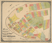
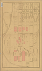
Map of property belonging to …
Map of lots belonging to the …
Map of Brooklyn Manor
Rosedale Square, Rosedale : 4…
Map of Jamaica in the 4th war…
Map of property New York Dock…
Map of Kissena Park, third wa…
East River Heights, first war…
Map of Bellaire Estates : own…
Hollis Terrace addition no. 1…
Map of 272 lots in the 30th w…
Map of Jamaica Fells : fourth…
m
Map of the borough of Queens,…
Borough Park Company
m
Sea Gate, New York Harbor
Map of Elmhurst Square : situ…
Livingston Heights : Livingto…
Map of portion of greater New…
Map showing locations of Dela…
A plott of ye situations of t…
Map of New York City between …
m
Map of the original grants of…
Property nos. 43, 45, and 47 …
m
Property identification map o…
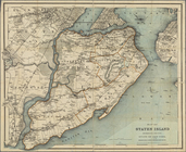
Map of Staten Island, Richmon…
Real estate map of property b…
m
Map of New York City from Bat…
m
Beers' new map of Staten Isla…
m
Map of the 23rd ward, New Yor…
Plan of streets etc. on the L…
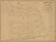
Norwood in the 24th ward of t…
Map of John W. Decker's house…
Bronx plat map, Alexander to …
Fieldston, Riverdale-on-Hudso…
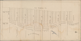
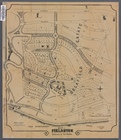
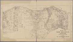
Map of New Brighton, Staten I…
Map of property at New Bright…
m
Map of the route of the New Y…
Map of property belonging to …
Index map to Bensonhurst-by-t…
Map of the Eureka Basin, incl…
Map of property owned by Fran…
Map of sewer district of Bath…
Index map to Bensonhurst-by-t…
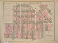
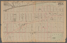
[Bounded by Avenue H, E. 18th…
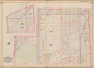
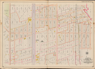
Plate 25: : [Bounded by Twelf…
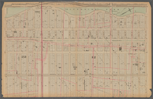
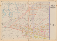
Plate 21: : [Bounded by E. 86…
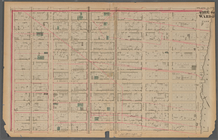
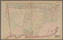
Plate 17:: Bounded by (Hudson…
Bounded by Avenue L, E. 19th …
Bounded by Stillwell Ave., Av…
Plate 37:: [Bounded by New Yo…
1
2
3
4
5
6
Previous
Next
1
2
3
4
5
6
Previous
Next