Click to visit the main New York Public Library Homepage
The New York Public Library
Digital Collections
About Digital Collections
Browse
Search only public domain materials
Items
Collections
Divisions
Home
Search
Browse
About
Search only public domain materials
Items
Collections
Divisions
Digital Collections
Using Images
Using Data
Search
Filtered search
Show filters
Hide filters
Show Only Public Domain
topic
x
Administrative and political divisions
Railroads
23
Indian reservations
8
Indians of North America
5
Roads
5
More
Less
name
Rand McNally and Company
8
G.W. & C.B. Colton & Co
7
United States. General Land Office
6
Julius Bien & Co
5
Strum, G. P. (Gustave P.)
4
More
Less
collection
Maps of North America
47
Maps of New York City and State
18
place
New York (State)
18
Alabama
5
Manhattan (New York, N.Y.)
5
New York (N.Y.)
5
United States
5
More
Less
genre
Maps
65
Cadastral maps
1
Geological maps
1
Illustrations
1
Road maps
1
More
Less
publisher
Rand, McNally & Co
5
G.W. & C.B. Colton & Co
3
Sampson, Davenport & Co
3
Board of Railroad Commissioners of the State of New York
2
Census Office
2
More
Less
division
Map Division
65
type
cartographic
65
still image
2
text
1
Date Range
to
65 results found
Filtering on:
x
Date
: 1881 - 1884
x
Topic
: Administrative and political divisions
Sort by:
Title
Date created
Date digitized
Sequence
New map of the great metropol…
Map of New England with adjac…
m
New map of the city of Philad…
m
New map of the city of Philad…
Territory of Dakota
Rand McNally & Co.'s new sect…
m
Map of the state of Minnesota…
Post route map of the state o…
Official map of the state of …
Indian Territory
Map of the city of Cleveland,…
m
Copy of map of state of Flori…
Map of Kansas and western Mis…
Rand, McNally & Co.'s Kansas
Map of Kansas
m
Nell's topographical & townsh…
m
Colorado
Montana territory
m
Real-estate map of Chicago
Map of Arizona
Map of Oregon territory: prob…
Map of Oregon territory : pro…
Map of the states of Californ…
Territory of Idaho
Topographical & township map …
Map of the City of Baltimore:…
Map of Pittsburgh and Alleghe…
County map of the state of Te…
Map of the state of South Car…
[Rivers, county maps of the s…
Map of North Carolina
County map of the states of G…
County map of Kentucky and Te…
Topographical map of the stat…
Map of the state of Florida :…
m
Cram's rail road & township m…
[Cities and county map of the…
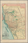
New map of the city of Buffalo
Map of Boston for 1884: publi…
Rand, McNally & Co.'s Alabama
Map of the state of Alabama :…
Map of Alabama
City of Taunton, 1884
New map of Boston from latest…
Alabama
Map of the city of Somerville…
m
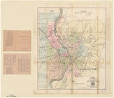
Map of the city of Rochester
Map of the Town of Milford, M…
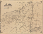
Map of the rail roads of the …
Map of the railroads of the s…