Click to visit the main New York Public Library Homepage
The New York Public Library
Digital Collections
About Digital Collections
Browse
Search only public domain materials
Items
Collections
Divisions
Home
Search
Browse
About
Search only public domain materials
Items
Collections
Divisions
Digital Collections
Using Images
Using Data
Search
Filtered search
Show filters
Hide filters
Show Only Public Domain
topic
Real property
3266
Fire insurance
3108
Cities & towns
3085
Railroads
104
Administrative and political divisions
103
More
Less
name
Sanborn Map Company
3085
Pidgeon, R. H. (Roger H.)
155
E. Robinson Co
154
Robinson, E. (Elisha)
108
G.M. Hopkins & Co
63
More
Less
collection
Atlases of New York City
3192
Maps of North America
314
Atlases of the United States
196
Maps of New York City and State
126
Century Company records
10
More
Less
place
New York (State)
3275
New York
111
New York (N.Y.)
106
New Jersey
78
Brooklyn (New York, N.Y.)
61
More
Less
genre
Maps
3866
Atlases
194
Cadastral maps
45
Topographic maps
27
Prints
15
More
Less
publisher
Sanborn Map Company
3085
E. Robinson Co
107
The Company
65
E. Robinson
48
C.B. Brush
39
More
Less
division
Map Division
3838
Rare Book Division
14
Manuscripts and Archives Division
13
Schomburg Jean Blackwell Hutson Research and Reference Division
3
Dorot Jewish Division
2
More
Less
type
x
cartographic
text
28
still image
16
Date Range
to
3,874 results found
Filtering on:
x
Date
: 1881 - 1887
x
Type
: cartographic
Sort by:
Title
Date created
Date digitized
Sequence
Results 251 - 300
Map of Wild-Wood Beach: locat…
Map of part of Bergen, Passai…
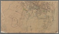
[Cities and county map of the…
Massachusetts
Geological map of New Jersey
Map of Washington and vicinity
Map of Niagara Falls, suspens…
Albany Rural Cemetery, 1884: …
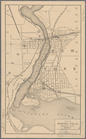
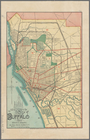
New map of the city of Buffalo
Océan Atlantique nord, côtes …
Map of the village of Lyon Mo…
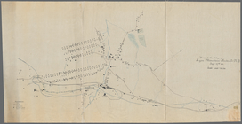
Map showing the rail roads wi…
m
Colton's map of the states an…
Penacook, N.H.: [bird's eye v…
Map of the city of Waltham, M…
Map of Salem and surrounding …
Map of Boston for 1884: publi…
Rand, McNally & Co.'s Alabama
Map of the state of Alabama :…
Map of Alabama
City of Taunton: [Massachuset…
City of Taunton, 1884
Improvement of Back Bay: show…
Map of the Boston & Lowell R.…
Map of the Connecticut River …
New map of Boston from latest…
General plan for sanitary imp…
Proposed park system from the…
Map of the city of Washington
Map of the city of Washington…
m
Map of the city of Washington…
Alabama
Map of the Sea Coast of Monmo…
m
Map of the city of Poughkeeps…
m
Colton's railroad and commerc…
Map of the city of Washington…
Preliminary plan for Wood Isl…
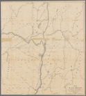
Diagram B, Township no. 6 Nor…
Map showing private land clai…
Map showing Indian reservatio…
Indian Territory, 1883
Map showing the public domain…
Precious metal regions of the…
Native races of the Pacific S…
m
Driving and cycling chart of …
Photolithograph of preliminar…
Railway and highway map of th…
Map of the city of New Bedfor…
Map of the city of Somerville…
Map of Boston for 1885: publi…
1
2
3
4
5
6
7
8
9
10
…
15
16
Previous
Next
1
2
3
4
5
6
7
8
9
10
…
15
16
Previous
Next