Click to visit the main New York Public Library Homepage
The New York Public Library
Digital Collections
About Digital Collections
Browse
Search only public domain materials
Items
Collections
Divisions
Home
Search
Browse
About
Search only public domain materials
Items
Collections
Divisions
Digital Collections
Using Images
Using Data
Search
Filtered search
Show filters
Hide filters
Show Only Public Domain
topic
x
Administrative and political divisions
Railroads
7
Indian reservations
3
Indians of North America
3
Local transit
3
More
Less
name
Strum, G. P. (Gustave P.)
4
United States. General Land Office
4
G.W. & C.B. Colton & Co
3
Julius Bien & Co
3
Rand McNally and Company
2
More
Less
collection
Maps of North America
10
Maps of New York City and State
7
place
New York (State)
7
Manhattan (New York, N.Y.)
4
New York (N.Y.)
4
Brooklyn (New York, N.Y.)
2
Hoboken (N.J.)
2
More
Less
genre
x
Maps
Geological maps
1
Topographic maps
1
publisher
General Land Office
2
Board of Railroad Commissioners of the State of New York
1
Chain & Hardy, Agents
1
Department of the Interior, General Land Office
1
G.W. & C.B. Colton & Co
1
More
Less
division
Map Division
17
type
cartographic
17
still image
1
text
1
Date Range
to
17 results found
Filtering on:
x
Date
: 1883 - 1883
x
Genre
: Maps
x
Topic
: Administrative and political divisions
Sort by:
Title
Date created
Date digitized
Sequence
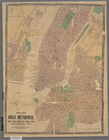
New map of the great metropol…
m
New map of the city of Philad…
Rand McNally & Co.'s new sect…
Post route map of the state o…
Indian Territory
m
Copy of map of state of Flori…
Map of Kansas
m
Nell's topographical & townsh…
Montana territory
Territory of Idaho
Map of the state of South Car…
Map of the rail roads of the …
m
Map of Long Island and the so…
Map of the Adirondack wildern…
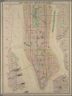
Map of the County of New York…
New map of the great metropol…
New York City south of 93rd S…
End of results
|
Top