Click to visit the main New York Public Library Homepage
The New York Public Library
Digital Collections
About Digital Collections
Browse
Search only public domain materials
Items
Collections
Divisions
Home
Search
Browse
About
Search only public domain materials
Items
Collections
Divisions
Digital Collections
Using Images
Using Data
Search
Filtered search
Show filters
Hide filters
Show Only Public Domain
topic
Real property
3781
Fire insurance
3330
Cities & towns
3307
Administrative and political divisions
194
Railroads
175
More
Less
name
Sanborn Map Company
3307
E. Robinson Co
307
Robinson, E. (Elisha)
304
Pidgeon, R. H. (Roger H.)
231
Austro-Hungarian Monarchy. Militärgeographisches Institut
82
More
Less
collection
Atlases of New York City
3728
Maps of North America
582
Atlases of the United States
387
Maps of New York City and State
254
Spezialkarte der Osterreichisch-Ungarischen Monarchie
82
More
Less
place
New York (State)
3931
New York
336
New York (N.Y.)
275
Manhattan (New York, N.Y.)
134
Bronx (New York, N.Y.)
110
More
Less
genre
Maps
5041
Atlases
387
Topographic maps
131
Cadastral maps
122
Plans
85
More
Less
publisher
Sanborn Map Company
3307
E. Robinson Co
306
K.u.K. Militargeographisches Institut
82
C. Wolverton
80
publisher not identified
69
More
Less
division
x
Map Division
type
cartographic
5038
text
44
still image
36
Date Range
to
5,069 results found
Filtering on:
x
Date
: 1883 - 1894
x
Division
: Map Division
Sort by:
Title
Date created
Date digitized
Sequence
Results 751 - 800
Modification in the pierhead…
m
Plan of the Harlem River Driv…
Map showing location of works…
m
Map of part of New York City:…
Property nos. 43, 45, and 47 …
A map of the City of New York…
Plan of the extension of the …
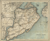
Map of Staten Island, Richmon…
Real estate map of property b…
m
Map of New York City from Bat…
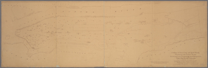
Bay and harbor of New York
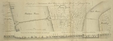
Project for a submarine rail …
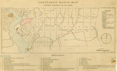
Cortlandt Manor map : prepare…
Map of Livingston Manor, 1714
m
Beers' new map of Staten Isla…
Blackwell's, Ward's and Randa…
m
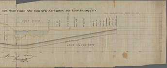
Profile of the New York and L…
m
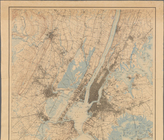
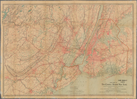
New York City and Vicinity.
Rand Mc Nally & Co.'s road ma…
m
Map of the 23rd ward, New Yor…
m
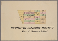
Maps of the 14, 15, 16, 17, 2…
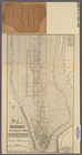
Map of the City of New York :…
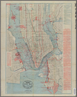
Map of New York City
Map of the County of New York…
Sketch map of the city of New…
New map of the great metropol…
New York City south of 93rd S…
m
Taunton new guide map and dir…
Sketch map of the city of New…
Map of New-York City / prepar…
[Negative photostat of] Trow …
Map showing corporation and o…
Map of New York City and surr…
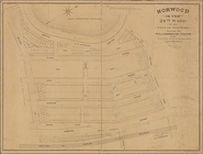
Norwood in the 24th ward of t…
Map of John W. Decker's house…
m
Map showing steam, cable, and…
m
Map or plan showing the stree…
Map showing the location of t…
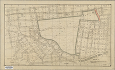
Bronx plat map, Alexander to …
m
General plan, Third Avenue Br…
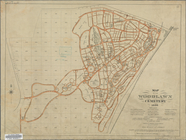
Map of the Woodlawn Cemetery
Map or plan of section 10 [Cr…
m
Map of the Harlem River and S…
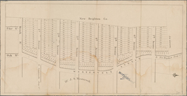
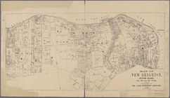
Map of New Brighton, Staten I…
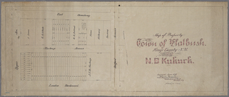
Map of property in the town o…
Map of property belonging to …
Index map to Bensonhurst-by-t…
m
Map of the enlarged city of B…
Watson's new map of Brooklyn …
m
Taunton's guide map and direc…
1
2
3
4
5
6
7
8
9
10
…
20
21
Previous
Next
1
2
3
4
5
6
7
8
9
10
…
20
21
Previous
Next