Click to visit the main New York Public Library Homepage
The New York Public Library
Digital Collections
About Digital Collections
Browse
Search only public domain materials
Items
Collections
Divisions
Home
Search
Browse
About
Search only public domain materials
Items
Collections
Divisions
Digital Collections
Using Images
Using Data
Search
Filtered search
Show filters
Hide filters
Show Only Public Domain
topic
Real property
3770
Fire insurance
3325
Cities & towns
3302
Administrative and political divisions
194
Railroads
175
More
Less
name
Sanborn Map Company
3302
E. Robinson Co
298
Robinson, E. (Elisha)
297
Pidgeon, R. H. (Roger H.)
225
Austro-Hungarian Monarchy. Militärgeographisches Institut
82
More
Less
collection
Atlases of New York City
3712
Maps of North America
582
Atlases of the United States
387
Maps of New York City and State
254
Spezialkarte der Osterreichisch-Ungarischen Monarchie
82
More
Less
place
New York (State)
3920
New York
331
New York (N.Y.)
270
Manhattan (New York, N.Y.)
132
Bronx (New York, N.Y.)
107
More
Less
genre
Maps
5078
Atlases
387
Topographic maps
131
Cadastral maps
122
Plans
86
More
Less
publisher
Sanborn Map Company
3302
E. Robinson Co
297
K.u.K. Militargeographisches Institut
82
C. Wolverton
80
publisher not identified
69
More
Less
division
Map Division
5038
Rare Book Division
14
Schomburg Jean Blackwell Hutson Research and Reference Division
14
Manuscripts and Archives Division
13
General Research Division
7
More
Less
type
x
cartographic
text
43
still image
32
Date Range
to
5,092 results found
Filtering on:
x
Date
: 1883 - 1894
x
Type
: cartographic
Sort by:
Title
Date created
Date digitized
Sequence
Results 251 - 300
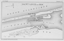
Saint - Louis en 1854
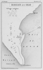
Dakar en 1850
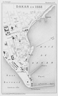
Dakar en 1888
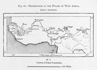
Distribution of Fulahs in Wes…
Guide map of the city of Los …
California, Nevada City speci…
The City of Stockton and vici…
Map of the City of San Jose
Geological map of Shasta Coun…
Map of the City of Oakland an…
Map of the city of Oakland, B…
m
The City of Stockton and vici…
Entrance to Wilmington Harbor…
Sectional map of Colfax and M…
La Mesa Colony : San Diego Co…
Map of the Forest Hill Divide…
m
Topographical and irrigation …
The ancient channel system be…
Map showing ancient channel s…
Map of Wilmington Harbor, Cal…
m
Faust's map of city and count…
State of Nevada
Guidemap of the City of San F…
Guidemap of the City of San F…
Rand McNally & Co's. indexed …
Guidemap of the City of San F…
Guidemap of the city of San F…
Guidemap of the City of San F…
Alaska Peninsula and adjacent…
Rand, McNally & Co.'s Ohio
Railroad map of Ohio
Kauai government survey, 1878
Part of the city of Honolulu,…
Map of San Francisco, Cal., s…
Official railroad map of the …
Official map of San Francisco
m
Official map of south-west po…
State of Indiana
Rand, McNally & Co.'s Indiana
Baltimore and its neighborhoo…
m
Rand, McNally & Co.'s new and…
m
The Union News Company's new …
Baltimore in 1889
m
Smith's map of the city of Ph…
Albertson's map of the city o…
Map of St. Joseph, Mo. and vi…
State of Nebraska
Official railroad map of Nebr…
m
Map of Carroll County, Iowa :…
m
Map of Dallas County, Iowa : …
1
2
3
4
5
6
7
8
9
10
…
20
21
Previous
Next
1
2
3
4
5
6
7
8
9
10
…
20
21
Previous
Next