Click to visit the main New York Public Library Homepage
The New York Public Library
Digital Collections
About Digital Collections
Browse
Search only public domain materials
Items
Collections
Divisions
Home
Search
Browse
About
Search only public domain materials
Items
Collections
Divisions
Digital Collections
Using Images
Using Data
Search
Filtered search
Show filters
Hide filters
Show Only Public Domain
topic
x
History
Cartography
103
Boundaries
7
Landowners
3
Real property
3
More
Less
name
Beauplan, Guillaume Le Vasseur, sieur de, approximately 1600-
21
Batiushkov, P. N. (Pompeĭ Nikolaevich) (1811-1892)
9
Barclay, Anthony, 1792-1877
7
Gastaldi, Giacomo, approximately 1500-approximately 1565
7
Herberstein, Sigmund, Freiherr von, 1486-1566
7
More
Less
collection
Materīaly po istorīi russkoĭ kartografīi
103
Maps of North America
18
Pamiatniki stariny v zapadnykh guberniakh imperii
9
Maps of New York City and State
8
Division and reunion, 1829-1889
2
More
Less
place
Russia
103
United States
19
Vilnius (Lithuania)
9
Volhynia (Ukraine)
9
Canada
7
More
Less
genre
Maps
142
Prints
9
Illustrations
5
Cadastral maps
3
Charts
1
More
Less
publisher
Tip. S.V. Kulʹzhenko
103
Izd. Ministerstvom vnutrennikh del
9
U.S. Light-House Board
7
publisher not identified
6
Longmans, Green, and Co
2
More
Less
division
General Research Division
103
Map Division
26
Rare Book Division
9
Schomburg Jean Blackwell Hutson Research and Reference Division
3
Wallach Division: Print Collection
1
type
x
cartographic
text
8
still image
4
Date Range
to
142 results found
Filtering on:
x
Date
: 1885 - 1899
x
Topic
: History
x
Type
: cartographic
Sort by:
Title
Date created
Date digitized
Sequence
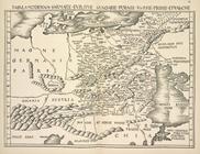
Plan of the French and Americ…
m
Map of the St. Clair River : …
m
Map of the river Sainte Mary …
Lake St. Clair
No. 3, map of Isle Royale in …
Detroit 1820
A topographical map of the no…
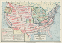
Status of slavery in the Unit…
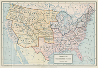
The United States, March 4, 1…
Boston with its environs
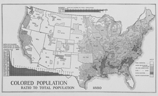
Colored population ratio to t…
Map showing the location of b…
Map of revolutionary camp gro…
Map of Brooklyn during the Ba…
[Pla]n of the Siege of Yorkto…
m
Map of Elizabeth City Co., Va…
Map of the vicinity of Richmo…
Statistical map of the United…
Eastern Virginia showing the …
Plan of West Point
The route of the army under t…
Historical sketch map of King…
Historical map of Nantucket
Operations after the evacuati…
m
History of the United States:…
Map of Cuba its provinces, ra…
Map of historic Niagara: show…
The second section of the sur…
m
Niagara 1819
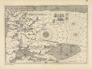
Plan of Savannah and the isla…
Karta Chernago moria iz porto…
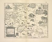
Karta Tabula Moderna Sarmatia…
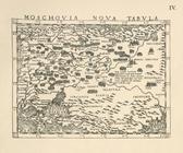
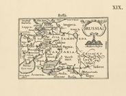
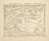
Karta Rossii Batisty Agneze 1…
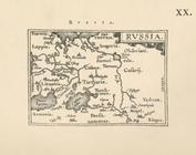
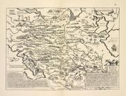
Karta Rossii by Ia. Gastal'do…
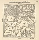
Karta Rossii Gerbershteina, g…
Karta Rossii Dzhenkinsona 156…
Karta Rossii Dzhenkinsona iz …
Karta Rossii Dzhenkinsona iz …
Karta Rossii Dzhenkinsona iz …
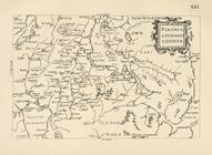
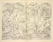
Karta Polonia, Lithania, Livo…
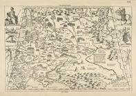
Karta Iugo-Zapadnoi Rossii Ia…
Karta Rossii Ia. Gastal'do 15…
Karta Rossii Antoniia Vida ok…
Karta Rossii Seb. Miunstera i…
Karta Rossii Seb. Miunstera i…
Karta srednei Rossii Seb. Miu…
Karta iugo-vostochnoi Rossii …
Karta Rossii Gerbershteina, g…
Karta Rossii Gerbershteina iz…
Karta Rossii Gerbershteina iz…