Click to visit the main New York Public Library Homepage
The New York Public Library
Digital Collections
About Digital Collections
Browse
Search only public domain materials
Items
Collections
Divisions
Home
Search
Browse
About
Search only public domain materials
Items
Collections
Divisions
Digital Collections
Using Images
Using Data
Search
Filtered search
Show filters
Hide filters
Show Only Public Domain
topic
History
2
Slavery
2
Description and travel
1
Slave trade
1
name
Faidherbe, Louis Léon César, 1818-1889
2
Edward Stanford Ltd
1
Maclure and MacDonald Lithographers
1
Madan, A. C. (Arthur Cornwallis), 1846-
1
Mathers, Edward P. (Edward Peter), 1850-1924
1
collection
Division and reunion, 1829-1889
2
Le Sénégal; la France dans l'Afrique occidentale: ouvrage contenant 18 gravures d'après les dessins de Riou, 3 gravures de Thiriat d'après des photographies et 5 cartes ou plans
2
A map of Zambesia
1
Dominii e protettorati italiani nell'eritrea e regioni limitrofe: (Sudan, Abissinia, Harar)
1
Kiunangi : or, Story and history from Central Africa
1
More
Less
place
Africa
2
Senegal
2
United States
2
Antilles, Lesser
1
Dakar (Senegal : Region)
1
More
Less
genre
x
Maps
Illustrations
6
publisher
Hachette et cie
2
Longmans, Green, and Co
2
D. Appleton
1
G. Bell
1
Maclure & co
1
More
Less
division
x
Schomburg Jean Blackwell Hutson Research and Reference Division
type
cartographic
10
Date Range
to
10 results found
Filtering on:
x
Date
: 1886 - 1896
x
Division
: Schomburg Jean Blackwell Hutson Research and Reference Division
x
Genre
: Maps
Sort by:
Title
Date created
Date digitized
Sequence
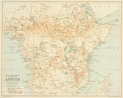
Slave trade map of equatorial…
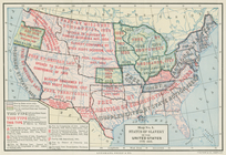
Status of slavery in the Unit…
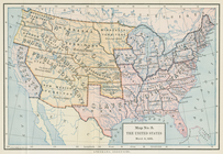
The United States, March 4, 1…
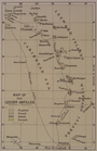
Map of the Lesser Antilles
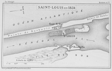
Saint - Louis en 1854
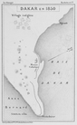
Dakar en 1850
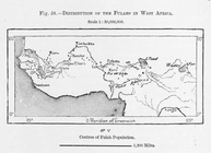
Distribution of Fulahs in Wes…
Dominii e protettorati italia…
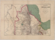
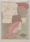
The Graphic map of South-Cent…
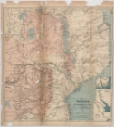
A map of Zambesia