Click to visit the main New York Public Library Homepage
The New York Public Library
Digital Collections
About Digital Collections
Browse
Search only public domain materials
Items
Collections
Divisions
Home
Search
Browse
About
Search only public domain materials
Items
Collections
Divisions
Digital Collections
Using Images
Using Data
Search
Filtered search
Show filters
Hide filters
Show Only Public Domain
topic
Administrative and political divisions
5
Railroads
5
Real property
5
Indians of North America
3
Roads
3
More
Less
name
Rand McNally and Company
3
Britton & Rey
2
Adams & Co
1
Asher & Adams
1
Bromley, George Washington
1
More
Less
collection
Maps of North America
15
Century Company records
8
Atlases of New York City
2
Maps of Asia
1
Maps of New York City and State
1
place
California
3
New York
3
New York (State)
3
Idaho
2
New Jersey
2
More
Less
genre
x
Maps
Correspondence
7
Clippings
4
Illustrations
3
Cadastral maps
2
More
Less
publisher
Berlin
1
Denver & Rio Grande Railroad System
1
Department of Agriculture
1
E. Robinson Co
1
Fairmount Land Co.?
1
More
Less
division
Map Division
19
Manuscripts and Archives Division
8
type
x
text
cartographic
26
still image
7
Date Range
to
27 results found
Filtering on:
x
Date
: 1886 - 1896
x
Genre
: Maps
x
Type
: text
Sort by:
Title
Date created
Date digitized
Sequence
m
Map of property at Fairmount…
m
Memoranda
m
Lehman, A.E
m
Law, E.M
m
Pearce, Nicholas Bartlett
m
Park, L.Y
m
Hunt, Leavitt
m
Hill, Daniel Harvey
m
Map of the Denver & Rio Grand…
m
Rand, McNally & Co.'s new bus…
m
Map of Chickamauga & Chattano…
State of Idaho
Idaho
m
Climatic map of California
The City of Stockton and vici…
m
The City of Stockton and vici…
m
Faust's map of city and count…
Labor commissioner's official…
m
Official map of Georgia
m
Rand, McNally & Co.'s new ind…
m
Watson and Adams new topograp…
m
Cabell, William D
m
Weather map, January 9, 1886:…
m
Staten Island drive and bicyc…
Block Index
Key and Index
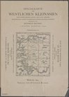
Specialkarte vom westlichen K…
End of results
|
Top