Click to visit the main New York Public Library Homepage
The New York Public Library
Digital Collections
About Digital Collections
Browse
Search only public domain materials
Items
Collections
Divisions
Home
Search
Browse
About
Search only public domain materials
Items
Collections
Divisions
Digital Collections
Using Images
Using Data
Search
Filtered search
Show filters
Hide filters
Show Only Public Domain
topic
Real property
1595
Fire insurance
768
Cities & towns
743
Administrative and political divisions
215
Railroads
205
More
Less
name
Sanborn Map Company
745
Bromley, George Washington
227
Bromley, Walter Scott
227
G.W. Bromley & Co
226
Ullitz, Hugo
217
More
Less
collection
Atlases of New York City
1526
Maps of North America
673
Atlases of the United States
639
Maps of New York City and State
412
Spezialkarte der Osterreichisch-Ungarischen Monarchie
130
More
Less
place
New York (State)
1876
New York
719
Manhattan (New York, N.Y.)
340
New York (N.Y.)
268
Brooklyn (New York, N.Y.)
234
More
Less
genre
Maps
3630
Atlases
639
Topographic maps
218
Cadastral maps
115
Plans
87
More
Less
publisher
Sanborn Map Company
745
G.W. Bromley & Co
226
E. Robinson Co
212
K.u.K. Militargeographisches Institut
130
E.B. Hyde & Co
115
More
Less
division
Map Division
3444
General Research Division
112
Manuscripts and Archives Division
46
Schomburg Jean Blackwell Hutson Research and Reference Division
35
Wallach Division: Print Collection
6
More
Less
type
x
cartographic
text
54
still image
41
Date Range
to
3,653 results found
Filtering on:
x
Date
: 1887 - 1903
x
Type
: cartographic
Sort by:
Title
Date created
Date digitized
Sequence
m
Mapah derekh emet : Mapa Dere…
Zoological chart of the world…
m
Chart of the world exhibiting…
Records of searches in relati…
Map of the borough of Brookly…
Map of lots belonging to the …
m
The Blanchard Press correctly…
m
Rand, McNally & Co.'s complet…
m
New York City and vicinity
Erie Railroad suburban lines
Guide map to the Brooklyn and…
Map of the borough of Brookly…
The Brooklyn of the future : …
Map showing proposed extensio…
Map of the borough of Brookly…
Rand, McNally & Co.'s new han…
Map of New York City region a…
Rand McNally standard map of …
m
Map of New York City : showin…
Map of the City of New York :…
m
Sea Gate, New York Harbor
Map of the country thirty thr…
Center of New York, first cit…
Map of the City of New York a…
The strangers mercantile guid…
Map of the country thirty thr…
Map of the Hackensack & New Y…
Map of the Harlem River and S…
m
New guide map of New York Cit…
m
Manhattan borough and part of…
m
Rand-McNally standard map of …
The Matthews-Northrup up-to-d…
m
Plans for the improvement of …
m
Map of the borough of Brookly…
Plan of Bay Ridge Parkway
Map of the enlarged city of B…
Map of the 23rd and 24th ward…
Proposed site on Staten Islan…
m
Driving road chart of the cou…
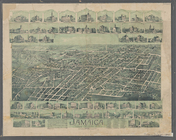
Jamaica, Long Island, N.Y
Bridgman's new map of the Cit…
m
Rand McNally & Co.'s road map…
Map showing the proposed area…
m
Map of the Passaic and Croton…
Map of New York City : showin…
m
Map of the metropolitan distr…
Livingston Heights : Livingto…
m
Topographical map of New York…
Map of portion of greater New…
Map of the borough of Manhatt…
1
2
3
4
5
6
7
8
9
10
…
14
15
Previous
Next
1
2
3
4
5
6
7
8
9
10
…
14
15
Previous
Next