Click to visit the main New York Public Library Homepage
The New York Public Library
Digital Collections
About Digital Collections
Browse
Search only public domain materials
Items
Collections
Divisions
Home
Search
Browse
About
Search only public domain materials
Items
Collections
Divisions
Digital Collections
Using Images
Using Data
Search
Filtered search
Show filters
Hide filters
Show Only Public Domain
topic
Real property
1574
Local transit
56
Railroads
41
Piers
35
Administrative and political divisions
26
More
Less
name
G.W. Bromley & Co
1620
Bromley, George Washington
389
Bromley, Walter Scott
389
E. Robinson Co
23
Mueller, A. H. (August H.)
22
More
Less
collection
Atlases of New York City
1642
Maps of New York City and State
159
I. N. Phelps Stokes Collection of American Historical Prints
2
Atlases, gazetteers, guidebooks and other books
1
Automobile blue book
1
More
Less
place
x
Manhattan (New York, N.Y.)
New York (State)
1765
New York
1554
New York (N.Y.)
496
Manhattan
59
More
Less
genre
x
Maps
Index maps
34
Manuscript maps
17
Outline maps
11
Cadastral maps
9
More
Less
publisher
G.W. Bromley & Co
1574
G.W. Bromley
46
E. Robinson Co
23
producer not identified
9
Rand, McNally & Co
8
More
Less
division
Map Division
1802
Manuscripts and Archives Division
2
Wallach Division: Print Collection
2
General Research Division
1
type
cartographic
1807
text
7
still image
3
Date Range
to
1,807 results found
Filtering on:
x
Date
: 1887 - 1964
x
Genre
: Maps
x
Place
: Manhattan (New York, N.Y.)
Sort by:
Title
Date created
Date digitized
Sequence
The Evening Mail's complete m…
Tracts and farms with street …
Carl Schurz Park
Park between 35th and 36th St…
Hagstrom's map of lower New Y…
m
Riverside Park
m
Map of Manhattan showing the …
Block sketch 1679, New York C…
m
Hammond's complete map of New…
Colonial Park
Rand McNally Map of Brooklyn
City Hall Park
m
Tentative height districts, M…
m
Tentative use districts, Manh…
Freight terminal map of New Y…
Center of New York, first cit…
Map of the Harlem River and S…
Hammond's new guide map of Ma…
Block line map of the heavy v…
m
Manhattan borough and part of…
m
Rand-McNally standard map of …
m
Hagstrom's map of upper New Y…
Williams' map of boroughs of …
Map of boroughs of Manhattan …
m
Hammond's new guide map of Ma…
m
Data for population from cens…
Map of the 23rd and 24th ward…
Map of New York City : showin…
Hagstrom's New York house-num…
m
Financial district map of New…
m
Borough of Manhattan, 300 foo…
Map of the borough of Manhatt…
Block no. 86 : confidential r…
m
Street guide of Manhattan and…
Map of the borough of Manhatt…
Greater New York's Census dis…
m
Rand McNally commercial map o…
Hagstrom's map of ... New Yor…
Map of Morningside Park
m
Map of original grants and fa…
Chief Points of Interest in L…
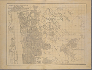
Upper Manhattan, comprising t…
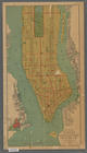
The lower end of Manhattan Is…
Werpoes, a village of the Man…
Yorkville and East Harlem in …
H4. Map (Scheme B) illustrati…
A topographical map of the no…
m
1906 Library map of Manhattan…
m
New map of the borough of Man…
Map of the 23rd and 24th ward…
1
2
3
4
5
6
7
8
Previous
Next
1
2
3
4
5
6
7
8
Previous
Next