Click to visit the main New York Public Library Homepage
The New York Public Library
Digital Collections
About Digital Collections
Browse
Search only public domain materials
Items
Collections
Divisions
Home
Search
Browse
About
Search only public domain materials
Items
Collections
Divisions
Digital Collections
Using Images
Using Data
Search
Filtered search
Show filters
Hide filters
Show Only Public Domain
topic
Discovery and exploration
8
Sewerage
5
Administrative and political divisions
4
Drainage
4
Parks
4
More
Less
name
Austro-Hungarian Monarchy. Militärgeographisches Institut
763
Geological Survey (U.S.)
40
New York (N.Y.). Department of Parks. Topographical Division
29
Julius Bien & Co
19
Vermeule, C. C. (Cornelius Clarkson), 1858-1950
16
More
Less
collection
Spezialkarte der Osterreichisch-Ungarischen Monarchie
763
Atlases of New York City
119
Maps of North America
63
Atlases of the United States
15
Maps of New York City and State
15
More
Less
place
Staten Island (New York, N.Y.)
90
Central Park (New York, N.Y.)
29
New York Metropolitan Area
19
New York (N.Y.)
17
New York (State)
13
More
Less
genre
x
Topographic maps
Maps
977
Atlases
15
Bathymetric maps
3
Physical maps
3
More
Less
publisher
K.u.K. Militargeographisches Institut
763
The Division
29
U.S. Geological Survey
22
Julius Bien & Co
15
U.S. Congress
9
More
Less
division
Map Division
976
General Research Division
1
type
x
cartographic
still image
1
text
1
Date Range
to
977 results found
Filtering on:
x
Date
: 1887 - 1966
x
Genre
: Topographic maps
x
Type
: cartographic
Sort by:
Title
Date created
Date digitized
Sequence
m
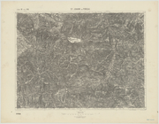
New York City and vicinity
Topographical map showing str…
m
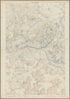
New York und Umgegend
Relief map of New York and vi…
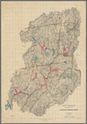
m
Topographical map of New York…
St. Johann im Pongau
Cessières
Washington and vicinity, Mary…
m
United States
Map of the country about Bost…
Topographical map of Fairmoun…
Map of Mount Desert Island, M…
Colorado, Tenmile District sp…
Colorado (Dolores County), Ri…
Colorado : Aspen special map
m
Map of Rock Creek Park, being…
Nell's topographical map of t…
Montana Fort Logan sheet
Montana Helena sheet
Montana, Helena special map
Topographic sheet, Montana (S…
A geological and topographica…
Detailed map of part of Canyo…
Alaska : Fortymile quadrangle
Hawaiian or Sandwich Islands
California (Nevada Co.), Neva…
California, Nevada City speci…
California (Los Angeles Co.) …
m
Topographical and irrigation …
Hawaiian Islands
Explorations in Alaska, 1898 …
Alaska military expedition : …
Explorations in Alaska, 1898 …
Explorations in Alaska, 1898 …
Explorations in Alaska, 1898 …
Explorations in Alaska, 1898 …
Alaska route of military expe…
The Hawaiian Islands: compile…
Alaska military expedition : …
Illinois--Missouri, St. Louis…
Philadelphia and vicinity : P…
Topographical plan showing po…
Metropolitan district of Chic…
United States contour map
Plate II: Contour map of New …
Plate I: General map of the P…
Plate III: Map of New Orleans…
Plate IV: Map of New Orleans…
Aqueduct Commissioners topogr…
Topographical map of the Dist…
1
2
3
4
Previous
Next
1
2
3
4
Previous
Next