Click to visit the main New York Public Library Homepage
The New York Public Library
Digital Collections
About Digital Collections
Browse
Search only public domain materials
Items
Collections
Divisions
Home
Search
Browse
About
Search only public domain materials
Items
Collections
Divisions
Digital Collections
Using Images
Using Data
Search
Filtered search
Show filters
Hide filters
Show Only Public Domain
topic
Railroads
143
Local transit
79
Real property
79
Administrative and political divisions
72
Roads
62
More
Less
name
Rand McNally and Company
38
Ohman, August R
25
Welcke, Robert A
25
C.S. Hammond & Company
21
G.W. & C.B. Colton & Co
16
More
Less
collection
x
Maps of New York City and State
place
New York (State)
521
New York
362
New York (N.Y.)
197
Manhattan (New York, N.Y.)
161
Brooklyn (New York, N.Y.)
104
More
Less
genre
Maps
845
Cadastral maps
49
Pamphlets
35
Manuscript maps
26
Road maps
26
More
Less
publisher
publisher not identified
36
The Company
28
publisher unknown
18
G.W. & C.B. Colton & Co
17
Museum of the American Indian, Heye Foundation
12
More
Less
division
Map Division
846
Manuscripts and Archives Division
1
type
x
cartographic
text
38
still image
10
Date Range
to
847 results found
Filtering on:
x
Date
: 1887 - 1966
x
Collection
: Maps of New York City and State
x
Type
: cartographic
For more collection details, visit the
Maps of New York City and State collection page
.
Sort by:
Title
Date created
Date digitized
Sequence
Results 501 - 550
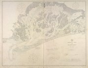
Jamaica Bay and Rockaway Inle…
m
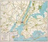
Map of routes to the Holland …
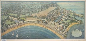
Playland," Rye Beach : Westch…
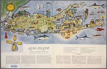
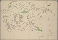
Long Island: an interpretive …
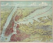
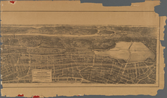
Bird's eye view map of New Yo…
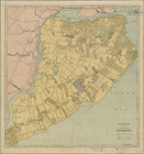
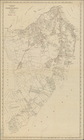
Map of the Borough of Richmon…
Map of Newtown Creek and vici…
Map of the Borough of Richmond
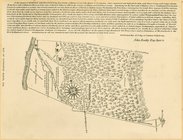
Map of Livingston Manor, 1714
Mt. Marcy, ed. of June 1902, …
m
Beers' new map of Staten Isla…
m
27th assembly district
Guide Map to the Brooklyn and…
m
1905 Library map of Manhattan…
m
Facsimile of the unpublished …
m
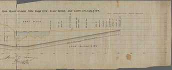
Profile of the New York and L…
m
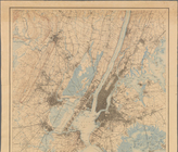
New York City and Vicinity.
Rand Mc Nally & Co.'s road ma…
Pocket map of greater New Yor…
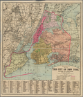
The City of New York, divided…
New York City and Vicinity.
Hammond's complete map of Sta…
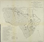
Richmond Borough Congressiona…
m
Birds eye view of that portio…
m
Map of the Queens Boro[ugh], …
m
Map of the 23rd ward, New Yor…
m
Authentic street plan of grea…
m
King's bird's eye view of Gre…
m
1907 Library map of Manhattan…
m
Population and school attenda…
m
Map of the northern part of t…
Hammond's new guide map of Ma…
Rand, McNally & Co.'s new han…
Map of the boroughs of Manhat…
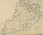
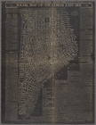
The lower part of New York Ci…
New York City
Map of the northern part of t…
m
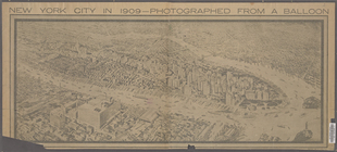
New York City in 1909: photog…
Block distribution of childre…
m
Map and plan showing the stre…
Social map of the Lower East …
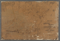
Queens Borough, City of New Y…
Guide map to the Parks and Pa…
New York City Free Public Edu…
Mobilization of the Atlantic …
m
Portion of New York City show…
The Heart of New York: Grand …
Hammond's new Guide Map of Ma…
m
New York City and Vicinity.
m
Panoramic view of New York Ci…
1
2
3
4
Previous
Next
1
2
3
4
Previous
Next