Click to visit the main New York Public Library Homepage
The New York Public Library
Digital Collections
About Digital Collections
Browse
Search only public domain materials
Items
Collections
Divisions
Home
Search
Browse
About
Search only public domain materials
Items
Collections
Divisions
Digital Collections
Using Images
Using Data
Search
Filtered search
Show filters
Hide filters
Show Only Public Domain
topic
Real property
62
Administrative and political divisions
24
Geology
22
Railroads
19
Landowners
12
More
Less
name
Pidgeon, R. H. (Roger H.)
45
Robinson, E. (Elisha)
45
Wolverton, Chester
45
Breou, Forsey
44
E. Robinson Co
44
More
Less
collection
Atlases of the United States
106
Maps of North America
47
Atlases of New York City
44
Maps of New York City and State
24
Le Sénégal; la France dans l'Afrique occidentale: ouvrage contenant 18 gravures d'après les dessins de Riou, 3 gravures de Thiriat d'après des photographies et 5 cartes ou plans
4
More
Less
place
New York (State)
68
New York
51
New York (N.Y.)
51
Monmouth County (N.J.)
46
Newark (N.J.)
40
More
Less
genre
Maps
226
Atlases
106
Plans
85
Surveys
44
Surveying
40
More
Less
publisher
C. Wolverton
44
E. Robinson Co
44
Scarlett & Scarlett
40
Julius Bien & Co.,
22
publisher not identified
10
More
Less
division
Map Division
222
Schomburg Jean Blackwell Hutson Research and Reference Division
5
General Research Division
3
Rare Book Division
1
type
x
cartographic
still image
4
text
1
Date Range
to
231 results found
Filtering on:
x
Date
: 1889 - 1889
x
Type
: cartographic
Sort by:
Title
Date created
Date digitized
Sequence
Map of the Hackensack & New Y…
Map showing the boundary of t…
Map of the Rhode Island state…
Railroad map of Wisconsin
Plan of the French and Americ…
Map of a portion of Point Ke…
New map of the city of Philad…
A correct map of the Oklahoma…
Outline map of the lands know…
Blanchard's guide map of Chic…
Map of the Lesser Antilles
A geological and topographica…
m
Rand McNally and Co's standar…
Birds-eye view of the Blue Gr…
State of Oregon
m
Map of Multnomah County, Oreg…
Oregon
County and township map of Or…
Bird's-eye view of the Conema…
Map of part of California, Ar…
Carte du Soudan occidental.
Saint - Louis en 1854
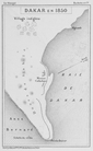
Dakar en 1850
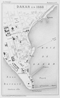
Dakar en 1888
Sectional map of Colfax and M…
Baltimore in 1889
m
County & township map of the …
Blanchard's map of Chicago, a…
Plan of the town Ebenezer and…
m
Supervisors districts elevent…
Rand McNally & Co.'s new offi…
Nashua River
Correct map of Florida : show…
Map of the city of Washington…
Topographical map of the Dist…
Florida Land and Improvement …
Plan of the Country Club Land…
1889, Larchmont Harbor, N.Y.:…
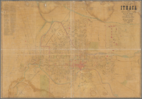
Map of City of Ithaca, N.Y.: …
Map of the lands known as the…
Map of modern Boston: from th…
m
Map of the United States show…
Driving road chart of Monmout…
Colton's road map of Monmouth…
State of Alabama
Vereinigte Staaten von Amerik…
Rand, McNally & Co.'s New Jer…
Birds-eye view of the White M…
Rambles and drives around Bet…
Plan showing land owned by th…