Click to visit the main New York Public Library Homepage
The New York Public Library
Digital Collections
About Digital Collections
Browse
Search only public domain materials
Items
Collections
Divisions
Home
Search
Browse
About
Search only public domain materials
Items
Collections
Divisions
Digital Collections
Using Images
Using Data
Search
Filtered search
Show filters
Hide filters
Show Only Public Domain
topic
Real property
212
Administrative and political divisions
55
Railroads
48
Cities & towns
42
Fire insurance
42
More
Less
name
Robinson, E. (Elisha)
122
E. Robinson Co
120
Pidgeon, R. H. (Roger H.)
87
Wolverton, Chester
45
Breou, Forsey
44
More
Less
collection
Atlases of New York City
162
Maps of North America
134
Atlases of the United States
106
Maps of New York City and State
61
Maps of Asia
16
More
Less
place
New York (State)
220
New York
136
New York (N.Y.)
102
Monmouth County (N.J.)
47
Newark (N.J.)
40
More
Less
genre
Maps
488
Atlases
106
Plans
85
Surveys
44
Cadastral maps
41
More
Less
publisher
E. Robinson Co
120
C. Wolverton
44
Sanborn Map Company
42
Scarlett & Scarlett
40
Julius Bien & Co.,
22
More
Less
division
Map Division
480
Schomburg Jean Blackwell Hutson Research and Reference Division
7
General Research Division
3
Rare Book Division
2
Wallach Division: Photography Collection
1
type
x
cartographic
still image
8
text
4
Date Range
to
493 results found
Filtering on:
x
Date
: 1889 - 1890
x
Type
: cartographic
Sort by:
Title
Date created
Date digitized
Sequence
The strangers mercantile guid…
Map of the Hackensack & New Y…
m
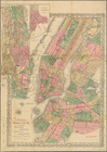
Topographical map of New York…
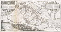
Vid osady Novgoroda iz Videki…
Map showing the boundary of t…
Map of the Rhode Island state…
m
Map of property at Fairmount…
Map of the boundary line betw…
Granitsa sela Ryshkanovki
Railroad map of Wisconsin
Plan of the French and Americ…
Kentucky
Map of a portion of Point Ke…
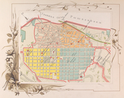
New map of the city of Philad…
A correct map of the Oklahoma…
Map of a portion of the Salem…
Outline map of the lands know…
Design map of the village of …
Indexed commercial map of Cin…
Map of Cincinnati and suburbs…
Blanchard's guide map of Chic…
Kansas
Bayfield & Ashland Counties i…
Map of part of the state of C…
City of Spokane Falls, Washin…
Spokane Falls : showing in re…
Whitney's map of Seattle and …
Map of the country adjacent t…
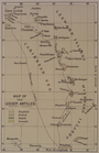
Map of the Lesser Antilles
A geological and topographica…
m
Rand McNally and Co's standar…
Birds-eye view of the Blue Gr…
State of Oregon
m
Map of Multnomah County, Oreg…
Map of Baker City, Oregon
Oregon
County and township map of Or…
Bird's-eye view of the Conema…
Alaska
Mineral territory tributary t…
m
Reconnaissance geological map…
Idaho
Map of part of California, Ar…
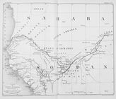
Carte du Soudan occidental.
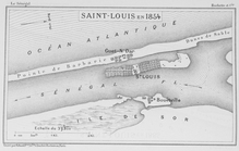
Saint - Louis en 1854
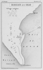
Dakar en 1850
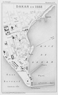
Dakar en 1888
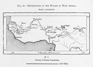
Distribution of Fulahs in Wes…
Map of the city of Oakland, B…
Sectional map of Colfax and M…
1
2
Previous
Next
1
2
Previous
Next