Click to visit the main New York Public Library Homepage
The New York Public Library
Digital Collections
About Digital Collections
Browse
Search only public domain materials
Items
Collections
Divisions
Home
Search
Browse
About
Search only public domain materials
Items
Collections
Divisions
Digital Collections
Using Images
Using Data
Search
Filtered search
Show filters
Hide filters
Show Only Public Domain
topic
Exhibitions
13694
Real property
8396
Fire insurance
5095
Cities & towns
5011
Streets
4596
More
Less
name
New York World's Fair (1939-1940 : New York, N.Y.)
13733
Sperr, Percy Loomis, 1890-1964
5841
Sanborn Map Company
5095
Colmer, Roy, 1935-2014
3122
Davies, Diana, 1938-
2517
More
Less
collection
New York World's Fair 1939 and 1940 Incorporated records
13630
Photographic views of New York City, 1870's-1970's, from the collections of the New York Public Library
10675
Robert N. Dennis collection of stereoscopic views
9270
Atlases of New York City
9171
Doors, NYC
3122
More
Less
place
x
New York (State)
New York
47526
New York (N.Y.)
27719
Manhattan (New York, N.Y.)
12193
Brooklyn (New York, N.Y.)
2609
More
Less
genre
Photographs
49411
Maps
10136
Stereographs
9270
Prints
1439
Postcards
754
More
Less
publisher
Sanborn Map Company
5009
G.W. Bromley & Co
2051
MIT Press
942
E. Belcher Hyde
557
Detroit Publishing Company
442
More
Less
division
Manuscripts and Archives Division
16977
Wallach Division: Photography Collection
15408
Milstein Division
14419
Map Division
10235
NYPL Archives
1714
More
Less
type
still image
53606
cartographic
9209
text
1290
sound recording
30
moving image
23
More
Less
Date Range
to
63,225 results found
Filtering on:
x
Date
: 1889 - 1983
x
Place
: New York (State)
Sort by:
Title
Date created
Date digitized
Sequence
Results 1001 - 1050
Proposed site on Staten Islan…
m
Map of the underground railwa…
Bridgman's new map of the Cit…
Grouping of troops and other …
m
Rand McNally & Co.'s road map…
Proposed location of the Narr…
A landmark map of City Hall P…
Map of New York City : showin…
Hagstrom's New York house-num…
m
Financial district map of New…
m
Borough of Manhattan, 300 foo…
m
Map of the metropolitan distr…
Map of the borough of Manhatt…
Freight terminal map of the P…
Block no. 86 : confidential r…
Livingston Heights : Livingto…
m
Topographical map of New York…
m
Street guide of Manhattan and…
Map of portion of greater New…
m
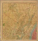
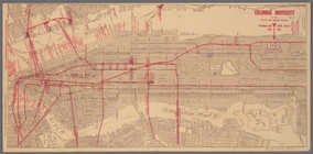
Columbia University in the Ci…
Map of the borough of Manhatt…
Greater New York's Census dis…
Map of New York City and vici…
m
Rand McNally commercial map o…
m
Hudson River vehicular tunnel…
Hagstrom's map of ... New Yor…
m
Vicinity of New York
Toll gates and intersection o…
Map of Morningside Park
Group portrait of contestants…
m
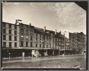
Fish Market, South Street
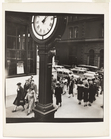
Library School of The New Yor…
m
Tempo of the City: I, Fifth A…
m
Harlem Street: II, 422-424 Le…
m
Old Post Office, Broadway and…
m
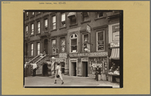
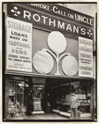
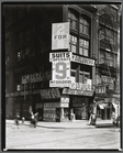
Rothman's Pawn Shop, 149 Eigh…
m
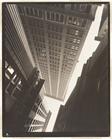
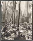
Canyon, Broadway and Exchange…
m
Theoline, Pier 11 or 12, East…
m
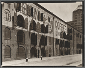
Warehouse, Water and Dock Str…
m
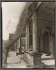
St. Mark's Church (Cloister),…
m
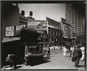
Union Square, 14th Street and…
m
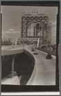
Triborough Bridge, East 125th…
m
William Goldberg, 771 Broadway
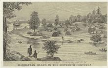
Manhattan Island in the sixte…
m
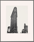
Flatiron building, 23rd Stree…
m
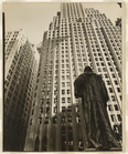
John Watts statue, From Trini…
m
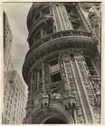
Facade: Alwyn Court, 174-182 …
m
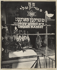
Chicken Market, 55 Hester Str…
m
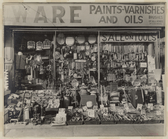
Hardware Store, 316 Bowery
m
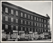
Fourth Avenue, No. 154
1
2
3
4
5
6
7
8
9
10
…
252
253
Previous
Next
1
2
3
4
5
6
7
8
9
10
…
252
253
Previous
Next