Click to visit the main New York Public Library Homepage
The New York Public Library
Digital Collections
About Digital Collections
Browse
Search only public domain materials
Items
Collections
Divisions
Home
Search
Browse
About
Search only public domain materials
Items
Collections
Divisions
Digital Collections
Using Images
Using Data
Search
Filtered search
Show filters
Hide filters
Show Only Public Domain
topic
x
Real property
Landowners
4
Local transit
2
Railroads
2
Administrative and political divisions
1
More
Less
name
Ullitz, Hugo
450
E.B. Hyde & Co
383
E. Belcher Hyde Map Company
332
Bromley, George Washington
295
G.W. Bromley & Co
295
More
Less
collection
Atlases of New York City
822
Maps of New York City and State
24
place
x
New York
New York (State)
846
Brooklyn (New York, N.Y.)
422
Maps
265
Manhattan (New York, N.Y.)
237
More
Less
genre
Maps
800
Indexes
70
Title pages
18
Index maps
11
Cadastral maps
7
More
Less
publisher
G.W. Bromley & Co
295
E. Belcher Hyde
267
E.B. Hyde & Co
118
E. Robinson Co
77
Hyde & Co
67
More
Less
division
Map Division
846
type
cartographic
768
text
96
still image
1
Date Range
to
846 results found
Filtering on:
x
Date
: 1890 - 1907
x
Place
: New York
x
Topic
: Real property
Sort by:
Title
Date created
Date digitized
Sequence
m
Map of property belonging to …
Map of lots belonging to the …
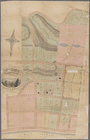
Map of Brooklyn Manor
Rosedale Square, Rosedale : 4…
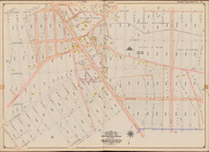
Map of Jamaica in the 4th war…
East River Heights, first war…
Hollis Terrace addition no. 1…
Map of 272 lots in the 30th w…
Map of Jamaica Fells : fourth…
m
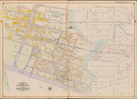
Map of the borough of Queens,…
m
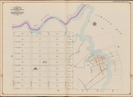
Sea Gate, New York Harbor
Map of Elmhurst Square : situ…
Livingston Heights : Livingto…
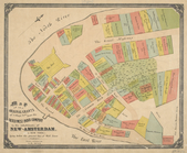
Map of portion of greater New…
Map of New York City between …
m
Map of the original grants of…
Property nos. 43, 45, and 47 …
m
Property identification map o…
Real estate map of property b…
m
Map of New York City from Bat…
Map of John W. Decker's house…
Bronx plat map, Alexander to …
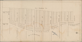
Map of property at New Bright…
Index map to Bensonhurst-by-t…
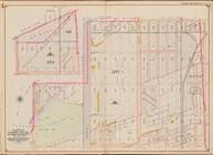
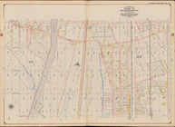
[Bounded by Avenue H, E. 18th…
Bounded by Avenue L, E. 19th …
Bounded by Stillwell Ave., Av…
Jamaica Bay and Rockaway Beac…
Bounded by Avenue Q, E. 36th …
Bounded by E. 52nd St., Avenu…
Bounded by W. 12th St., Avenu…
Bounded by Avenue V, Ocean Av…
Bounded by Avenue K, E. 53rd …
Bounded by (Fresh Creek) E. 1…
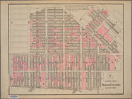
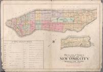
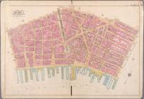
Atlas of the city of New York…
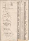
Outline and Index Map of Atla…
BLOCK INDEX. [Includes the ma…
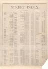
STREET INDEX [1] [Academy Pl…
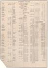
Street Index [2], [Hudson Str…
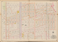
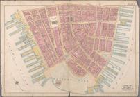
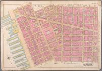
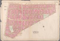
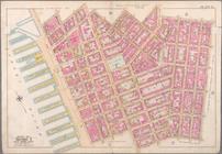
Bounded by Liberty Street, Ma…
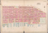
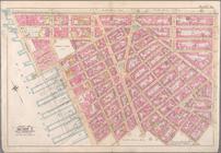
Bounded by Jay Street, Thomas…
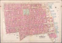
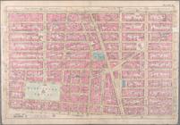
Bounded by William Street, Pa…
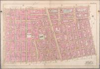
Bounded by Spring Street, Hud…
Bounded by Broome Street, Att…
Bounded by Division Street, G…
Bounded by E. 3rd Street, Tom…
Bounded by W. 3rd Street, Gre…
Bounded by Charles Street, Wa…
Bounded by W. 14th Street, Si…
Bounded by W. 14th Street, E.…
1
2
3
4
Previous
Next
1
2
3
4
Previous
Next